Bānka geodata
Bānka (Bihar) is a populated place; located in India in Asia/Kolkata (GMT+5.5) time zone. With population of 38,939 people, there are 1134 cities with bigger population in this country. Compared to other cities in India, 62.8% of cities are located further ↓South; 89.1% of cities are located further ←West and 71.8% of cities have higher elevation than Bānka. Note1


Bānka GPS coordinates[2]
24° 52' 51.276" North, 86° 55' 21.252" East
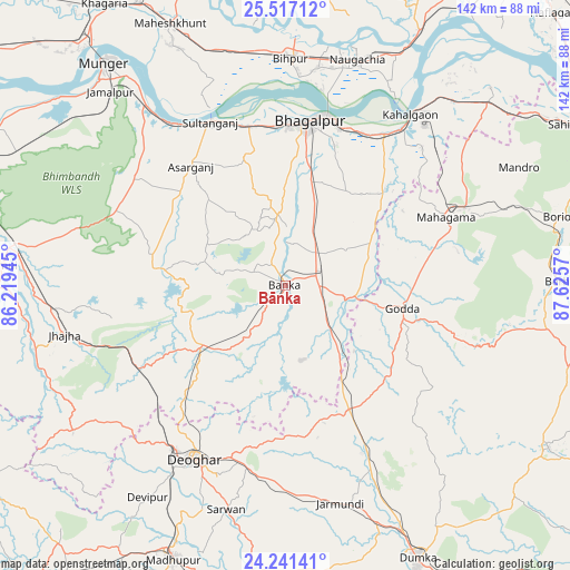
| Map corner | latitude | longitude |
|---|---|---|
| Upper-left | 25.51712°, | 86.21945° |
| Center: | 24.88091°, | 86.92257° |
| Lower-right: | 24.24141°, | 87.6257° |
| Map W x H: | 141.8×141.8 km | = 88.1×88.1mi |
| max Lat: | 34.9274° ⇑37.2% North |
| Bānka: | 24.88091° |
| min Lat: | ⇓62.8% South 8.09008° |
| min Long | Bānka | max Long |
| 68.82655° | 86.92257° | 96.81° |
| W 89.1%⇐ | ⇒10.9% E |
Elevation
Elevation of Bānka is 85 m = 279 ft, and this is 210.6 m = 691 ft below average elevation for this country.
| Max E: |
3681 m = 12077 ft | 71.8% |
| Avg. | 295.6 m = 970 ft | |
| Bānka | 85 m = 279 ft | |
Min E: |
1 m = 3 ft | 28.2% |
See also: India elevation on elevation.city.
Geographical zone
Bānka is located in North temperate zone (between Tropic of Cancer and the Arctic Circle). Distance of this Northern Tropic circle is 160.6 km =99.8 mi to South.| Distance of | km | miles | from Bānka |
|---|---|---|---|
| North Pole | 7240.6 | 4499.1 | to North |
| Arctic Circle | 4634.7 | 2879.9 | to North |
| Tropic Cancer | 160.6 | 99.8 | to South |
| Equator | 2766.5 | 1719 | to South |


Nearby cities:
15 places around Bānka: (largest is in red/bold)
• Amarpur
17.8 km =11.1 mi,  353°
353°
• Asarganj
38.3 km =23.8 mi,  321°
321°
• Bariārpur
57.1 km =35.5 mi, 322°
• Bhāgalpur
40.7 km =25.3 mi,  6°
6°
• Colgong
52.8 km =32.8 mi,  36°
36°
• Ghoga
44.2 km =27.5 mi,  32°
32°
• Godda
29.9 km =18.6 mi,  101°
101°
• Jamālpur
64.9 km =40.3 mi, 317°
• Jamūī
70.5 km =43.8 mi,  274°
274°
• Jasidih
49.5 km =30.8 mi,  214°
214°
• Jhā-Jhā
56.2 km =34.9 mi,  257°
257°
• Kharagpur
45.8 km =28.5 mi,  306°
306°
• Madhupur
73.3 km =45.5 mi,  203°
203°
• Monghyr
71 km =44.1 mi, 320°
• Naugachhia
59.1 km =36.7 mi,  17°
17°
Sources, notices
• [Note1] Compared only with cities in India existing in our database
• [Src1] Map data: © OpenStreetMap contributors (CC-BY-SA)
• [Src2] Other city data from geonames.org with taken over terms of usage.
• [Src3] Geographical zone / Annual Mean Temperature by Robert A. Rohde @ Wikipedia
