Jānjgīr geodata
Jānjgīr (Chhattisgarh) is a populated place; located in India in Asia/Kolkata (GMT+5.5) time zone. With population of 32,833 people, there are 1327 cities with bigger population in this country. Compared to other cities in India, 56.6% of cities are located further ↑North; 78.2% of cities are located further ←West and 63.9% of cities have lower elevation than Jānjgīr. Note1


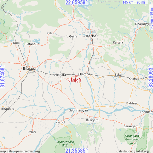
Jānjgīr GPS coordinates[2]
22° 0' 33.192" North, 82° 34' 40.08" East
| Map corner | latitude | longitude |
|---|---|---|
| Upper-left | 22.65959°, | 81.87468° |
| Center: | 22.00922°, | 82.5778° |
| Lower-right: | 21.35585°, | 83.28093° |
| Map W x H: | 145×145 km | = 90.1×90.1mi |
| max Lat: | 34.9274° ⇑56.6% North |
| Jānjgīr: | 22.00922° |
| min Lat: | ⇓43.4% South 8.09008° |
| min Long | Jānjgīr | max Long |
| 68.82655° | 82.5778° | 96.81° |
| W 78.2%⇐ | ⇒21.8% E |
Elevation
Elevation of Jānjgīr is 278 m = 912 ft, and this is 17.6 m = 58 ft below average elevation for this country.
| Max E: |
3681 m = 12077 ft | 36.1% |
| Avg. | 295.6 m = 970 ft | |
| Jānjgīr | 278 m = 912 ft | |
Min E: |
1 m = 3 ft | 63.9% |
See also: India elevation on elevation.city.
Geographical zone
Jānjgīr is located in North Torrid zone (between Equator and Tropic of Cancer). Distance of this Northern Tropic circle is 158.7 km =98.6 mi to North.| Distance of | km | miles | from Jānjgīr |
|---|---|---|---|
| North Pole | 7559.9 | 4697.5 | to North |
| Arctic Circle | 4954 | 3078.3 | to North |
| Tropic Cancer | 158.7 | 98.6 | to North |
| Equator | 2447.2 | 1520.6 | to South |


Nearby cities:
15 places around Jānjgīr: (largest is in red/bold)
• Akaltara
15.7 km =9.8 mi,  276°
276°
• Baloda
17.5 km =10.9 mi,  325°
325°
• Baloda Bāzār
58.2 km =36.2 mi,  227°
227°
• Bilāspur
44.2 km =27.5 mi, 280°
• Chāmpa
7.3 km =4.5 mi,  66°
66°
• Deori
62.3 km =38.7 mi,  176°
176°
• Katghora
55 km =34.2 mi,  356°
356°
• Kharod
29.5 km =18.3 mi, 179°
• Kharsia
54.4 km =33.8 mi,  92°
92°
• Korba
39.4 km =24.5 mi,  18°
18°
• Kotā
65.3 km =40.6 mi,  299°
299°
• Ratanpur
52.3 km =32.5 mi,  306°
306°
• Saktī
39.5 km =24.5 mi, 87°
• Seorīnārāyan
32.1 km =19.9 mi, 177°
• Sārangarh
69.9 km =43.4 mi,  132°
132°
Sources, notices
• [Note1] Compared only with cities in India existing in our database
• [Src1] Map data: © OpenStreetMap contributors (CC-BY-SA)
• [Src2] Other city data from geonames.org with taken over terms of usage.
• [Src3] Geographical zone / Annual Mean Temperature by Robert A. Rohde @ Wikipedia
