Gola Gokarannāth geodata
Gola Gokarannāth (Uttar Pradesh) is a populated place; located in India in Asia/Kolkata (GMT+5.5) time zone. With population of 58,986 people, there are 745 cities with bigger population in this country. Compared to other cities in India, 84.9% of cities are located further ↓South; 70.8% of cities are located further ←West and 57% of cities have higher elevation than Gola Gokarannāth. Note1


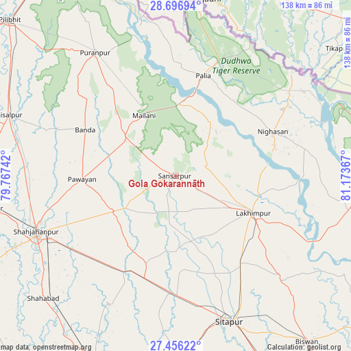
Gola Gokarannāth GPS coordinates[2]
28° 4' 42.132" North, 80° 28' 13.944" East
| Map corner | latitude | longitude |
|---|---|---|
| Upper-left | 28.69694°, | 79.76742° |
| Center: | 28.07837°, | 80.47054° |
| Lower-right: | 27.45622°, | 81.17367° |
| Map W x H: | 138×138 km | = 85.7×85.7mi |
| max Lat: | 34.9274° ⇑15.1% North |
| Gola Gokarannāth: | 28.07837° |
| min Lat: | ⇓84.9% South 8.09008° |
| min Long | Gola Gokarannā | max Long |
| 68.82655° | 80.47054° | 96.81° |
| W 70.8%⇐ | ⇒29.2% E |
Elevation
Elevation of Gola Gokarannāth is 164 m = 538 ft, and this is 131.6 m = 432 ft below average elevation for this country.
| Max E: |
3681 m = 12077 ft | 57% |
| Avg. | 295.6 m = 970 ft | |
| Gola Gokarannāth | 164 m = 538 ft | |
Min E: |
1 m = 3 ft | 43% |
See also: Gola Gokarannāth elevation on elevation.city.
Geographical zone
Gola Gokarannāth is located in North temperate zone (between Tropic of Cancer and the Arctic Circle). Distance of this Northern Tropic circle is 516.1 km =320.7 mi to South.| Distance of | km | miles | from Gola Gokarannāth |
|---|---|---|---|
| North Pole | 6885 | 4278.1 | to North |
| Arctic Circle | 4279.2 | 2659 | to North |
| Tropic Cancer | 516.1 | 320.7 | to South |
| Equator | 3122 | 1939.9 | to South |


Nearby cities:
15 places around Gola Gokarannāth: (largest is in red/bold)
• Amethi
57.3 km =35.6 mi,  96°
96°
• Bilsanda
54.1 km =33.6 mi,  289°
289°
• Kheri
37.5 km =23.3 mi,  121°
121°
• Khūtār
24 km =14.9 mi,  305°
305°
• Lakhīmpur
33.6 km =20.9 mi, 115°
• Lāharpur
59.1 km =36.7 mi,  134°
134°
• Maholi
46.1 km =28.6 mi,  179°
179°
• Mailāni
26.7 km =16.6 mi,  332°
332°
• Mohanpur
29.4 km =18.3 mi, 311°
• Paliā Kalān
40.8 km =25.4 mi,  15°
15°
• Pawāyan
36.1 km =22.4 mi,  267°
267°
• Pihānī
57.3 km =35.6 mi,  207°
207°
• Pūranpur
57.7 km =35.9 mi, 326°
• Shāhjānpur
59.3 km =36.8 mi,  248°
248°
• Sītāpur
61.1 km =38 mi,  160°
160°
Sources, notices
• [Note1] Compared only with cities in India existing in our database
• [Src1] Map data: © OpenStreetMap contributors (CC-BY-SA)
• [Src2] Other city data from geonames.org with taken over terms of usage.
• [Src3] Geographical zone / Annual Mean Temperature by Robert A. Rohde @ Wikipedia
