Paliā Kalān geodata
Paliā Kalān (Uttar Pradesh) is a populated place; located in India in Asia/Kolkata (GMT+5.5) time zone. With population of 38,547 people, there are 1142 cities with bigger population in this country. Compared to other cities in India, 86.5% of cities are located further ↓South; 71.3% of cities are located further ←West and 57.2% of cities have higher elevation than Paliā Kalān. Note1


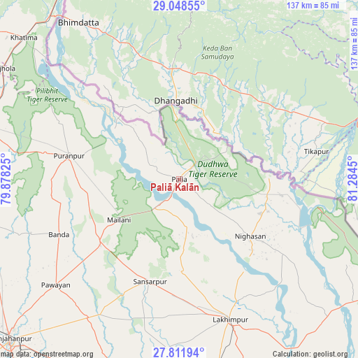
Paliā Kalān GPS coordinates[2]
28° 25' 55.38" North, 80° 34' 52.932" East
| Map corner | latitude | longitude |
|---|---|---|
| Upper-left | 29.04855°, | 79.87825° |
| Center: | 28.43205°, | 80.58137° |
| Lower-right: | 27.81194°, | 81.2845° |
| Map W x H: | 137.5×137.5 km | = 85.4×85.4mi |
| max Lat: | 34.9274° ⇑13.5% North |
| Paliā Kalān: | 28.43205° |
| min Lat: | ⇓86.5% South 8.09008° |
| min Long | Paliā Kalān | max Long |
| 68.82655° | 80.58137° | 96.81° |
| W 71.3%⇐ | ⇒28.7% E |
Elevation
Elevation of Paliā Kalān is 162 m = 531 ft, and this is 133.6 m = 438 ft below average elevation for this country.
| Max E: |
3681 m = 12077 ft | 57.2% |
| Avg. | 295.6 m = 970 ft | |
| Paliā Kalān | 162 m = 531 ft | |
Min E: |
1 m = 3 ft | 42.8% |
See also: India elevation on elevation.city.
Geographical zone
Paliā Kalān is located in North temperate zone (between Tropic of Cancer and the Arctic Circle). Distance of this Northern Tropic circle is 555.4 km =345.1 mi to South.| Distance of | km | miles | from Paliā Kalān |
|---|---|---|---|
| North Pole | 6845.7 | 4253.7 | to North |
| Arctic Circle | 4239.8 | 2634.5 | to North |
| Tropic Cancer | 555.4 | 345.1 | to South |
| Equator | 3161.3 | 1964.3 | to South |


Nearby cities:
15 places around Paliā Kalān: (largest is in red/bold)
• Amethi
65.1 km =40.5 mi,  135°
135°
• Barkhera Kalān
75.8 km =47.1 mi,  271°
271°
• Bilsanda
65.1 km =40.5 mi,  251°
251°
• Bīsalpur
77.6 km =48.2 mi,  258°
258°
• Dhaurahra
69.3 km =43.1 mi,  134°
134°
• Gola Gokarannāth
40.8 km =25.4 mi,  195°
195°
• Kheri
62.5 km =38.8 mi,  160°
160°
• Khūtār
39.7 km =24.7 mi,  230°
230°
• Kālīnagar
53.1 km =33 mi,  293°
293°
• Lakhīmpur
57.2 km =35.5 mi, 160°
• Mailāni
28 km =17.4 mi,  235°
235°
• Mohanpur
38.5 km =23.9 mi, 238°
• Pawāyan
62 km =38.5 mi, 229°
• Pīlibhīt
79.1 km =49.2 mi, 286°
• Pūranpur
43.3 km =26.9 mi,  281°
281°
Sources, notices
• [Note1] Compared only with cities in India existing in our database
• [Src1] Map data: © OpenStreetMap contributors (CC-BY-SA)
• [Src2] Other city data from geonames.org with taken over terms of usage.
• [Src3] Geographical zone / Annual Mean Temperature by Robert A. Rohde @ Wikipedia
