Gāndhīdhām geodata
Gāndhīdhām (Gujarat) is a populated place; located in India in Asia/Kolkata (GMT+5.5) time zone. With population of 166,388 people, there are 258 cities with bigger population in this country. Compared to other cities in India, 52.2% of cities are located further ↓South; 99.4% of cities are located further →East and 88.6% of cities have higher elevation than Gāndhīdhām. Note1


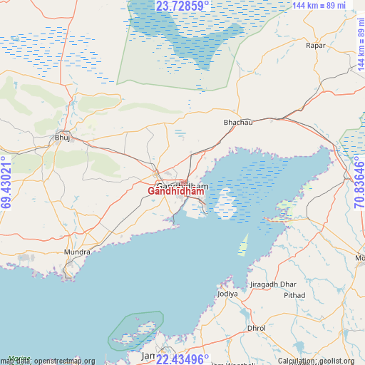
Gāndhīdhām GPS coordinates[2]
23° 4' 59.988" North, 70° 7' 59.988" East
| Map corner | latitude | longitude |
|---|---|---|
| Upper-left | 23.72859°, | 69.43021° |
| Center: | 23.08333°, | 70.13333° |
| Lower-right: | 22.43496°, | 70.83646° |
| Map W x H: | 143.8×143.8 km | = 89.4×89.4mi |
| max Lat: | 34.9274° ⇑47.8% North |
| Gāndhīdhām: | 23.08333° |
| min Lat: | ⇓52.2% South 8.09008° |
| min Long | Gāndhīdhām | max Long |
| 68.82655° | 70.13333° | 96.81° |
| W 0.6%⇐ | ⇒99.4% E |
Elevation
Elevation of Gāndhīdhām is 21 m = 69 ft, and this is 274.6 m = 901 ft below average elevation for this country.
| Max E: |
3681 m = 12077 ft | 88.6% |
| Avg. | 295.6 m = 970 ft | |
| Gāndhīdhām | 21 m = 69 ft | |
Min E: |
1 m = 3 ft | 11.4% |
See also: Gāndhīdhām elevation on elevation.city.
Geographical zone
Gāndhīdhām is located in North Torrid zone (between Equator and Tropic of Cancer). Distance of this Northern Tropic circle is 39.3 km =24.4 mi to North.| Distance of | km | miles | from Gāndhīdhām |
|---|---|---|---|
| North Pole | 7440.4 | 4623.2 | to North |
| Arctic Circle | 4834.5 | 3004 | to North |
| Tropic Cancer | 39.3 | 24.4 | to North |
| Equator | 2566.6 | 1594.8 | to South |


Nearby cities:
15 places around Gāndhīdhām: (largest is in red/bold)
• Anjār
11.4 km =7.1 mi,  286°
286°
• Bedi
65.4 km =40.6 mi,  188°
188°
• Bhachāu
32.1 km =19.9 mi,  41°
41°
• Bhuj
51.1 km =31.8 mi, 291°
• Dhrol
64.4 km =40 mi,  153°
153°
• Jamnagar
68.2 km =42.4 mi, 185°
• Jodiya Bandar
43.6 km =27.1 mi,  159°
159°
• Kāndla
10.2 km =6.3 mi,  123°
123°
• Morbi
77.9 km =48.4 mi,  112°
112°
• Mundra
50.1 km =31.1 mi,  237°
237°
• Māndvi
84.7 km =52.6 mi,  250°
250°
• Paddhari
86.5 km =53.7 mi, 146°
• Rāpar
75.6 km =47 mi, 43°
• Sikka
78.3 km =48.7 mi,  202°
202°
• Tankāra
79 km =49.1 mi,  126°
126°
Sources, notices
• [Note1] Compared only with cities in India existing in our database
• [Src1] Map data: © OpenStreetMap contributors (CC-BY-SA)
• [Src2] Other city data from geonames.org with taken over terms of usage.
• [Src3] Geographical zone / Annual Mean Temperature by Robert A. Rohde @ Wikipedia
