Dīglūr geodata
Dīglūr (Maharashtra) is a populated place; located in India in Asia/Kolkata (GMT+5.5) time zone. With population of 52,596 people, there are 851 cities with bigger population in this country. Compared to other cities in India, 70.3% of cities are located further ↑North; 56.4% of cities are located further →East and 74.8% of cities have lower elevation than Dīglūr. Note1


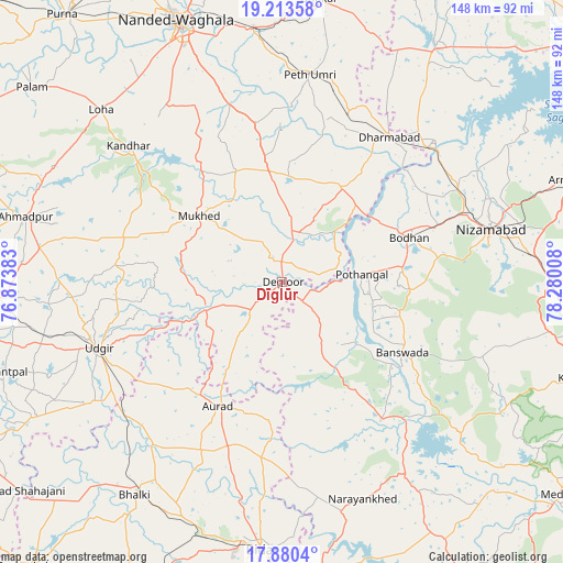
Dīglūr GPS coordinates[2]
18° 32' 53.844" North, 77° 34' 37.02" East
| Map corner | latitude | longitude |
|---|---|---|
| Upper-left | 19.21358°, | 76.87383° |
| Center: | 18.54829°, | 77.57695° |
| Lower-right: | 17.8804°, | 78.28008° |
| Map W x H: | 148.2×148.2 km | = 92.1×92.1mi |
| max Lat: | 34.9274° ⇑70.3% North |
| Dīglūr: | 18.54829° |
| min Lat: | ⇓29.7% South 8.09008° |
| min Long | Dīglūr | max Long |
| 68.82655° | 77.57695° | 96.81° |
| W 43.6%⇐ | ⇒56.4% E |
Elevation
Elevation of Dīglūr is 383 m = 1257 ft, and this is 87.4 m = 287 ft above average elevation for this country.
| Max E: |
3681 m = 12077 ft | 25.2% |
| Dīglūr | 383 m 1257 ft | |
| Avg. | 295.6 m = 970 ft | |
Min E: |
1 m = 3 ft | 74.8% |
See also: Dīglūr elevation on elevation.city.
Geographical zone
Dīglūr is located in North Torrid zone (between Equator and Tropic of Cancer). Distance of this Northern Tropic circle is 543.5 km =337.7 mi to North.| Distance of | km | miles | from Dīglūr |
|---|---|---|---|
| North Pole | 7944.7 | 4936.6 | to North |
| Arctic Circle | 5338.8 | 3317.4 | to North |
| Tropic Cancer | 543.5 | 337.7 | to North |
| Equator | 2062.4 | 1281.5 | to South |


Nearby cities:
15 places around Dīglūr: (largest is in red/bold)
• Ahmadpur
69.6 km =43.2 mi,  284°
284°
• Aurād
36.8 km =22.9 mi,  207°
207°
• Bhaisa
74.8 km =46.5 mi,  32°
32°
• Bhālki
68.4 km =42.5 mi, 214°
• Biloli
29.5 km =18.3 mi, 31°
• Bodhan
34.9 km =21.7 mi,  68°
68°
• Bānswāda
37.2 km =23.1 mi,  120°
120°
• Bīdar
70.8 km =44 mi,  184°
184°
• Dharmābād
47.7 km =29.6 mi,  36°
36°
• Kondalwādi
35.3 km =21.9 mi, 35°
• Mudkhed
68.1 km =42.3 mi,  353°
353°
• Mukher
28.2 km =17.5 mi,  308°
308°
• Nanded
73.4 km =45.6 mi,  337°
337°
• Nizāmābād
56.7 km =35.2 mi,  76°
76°
• Udgīr
51.4 km =31.9 mi,  250°
250°
Sources, notices
• [Note1] Compared only with cities in India existing in our database
• [Src1] Map data: © OpenStreetMap contributors (CC-BY-SA)
• [Src2] Other city data from geonames.org with taken over terms of usage.
• [Src3] Geographical zone / Annual Mean Temperature by Robert A. Rohde @ Wikipedia
