Daulatpur geodata
Daulatpur (West Bengal) is a populated place; located in India in Asia/Kolkata (GMT+5.5) time zone. With population of 7,620 people, there are 3157 cities with bigger population in this country. Compared to other cities in India, 65.4% of cities are located further ↓South; 93% of cities are located further ←West and 83% of cities have higher elevation than Daulatpur. Note1


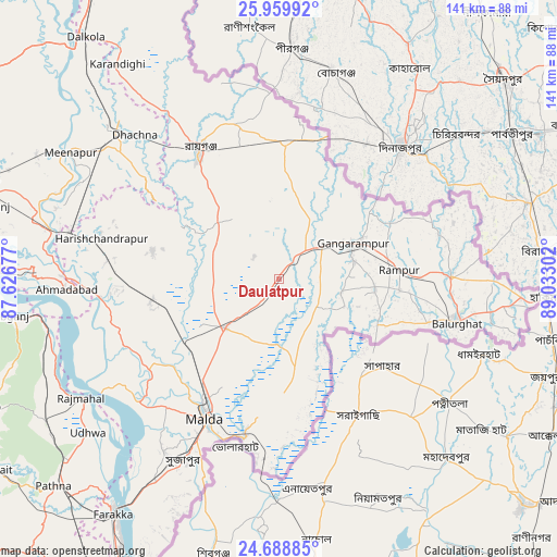
Daulatpur GPS coordinates[2]
25° 19' 33.78" North, 88° 19' 47.604" East
| Map corner | latitude | longitude |
|---|---|---|
| Upper-left | 25.95992°, | 87.62677° |
| Center: | 25.32605°, | 88.32989° |
| Lower-right: | 24.68885°, | 89.03302° |
| Map W x H: | 141.3×141.3 km | = 87.8×87.8mi |
| max Lat: | 34.9274° ⇑34.6% North |
| Daulatpur: | 25.32605° |
| min Lat: | ⇓65.4% South 8.09008° |
| min Long | Daulatpur | max Long |
| 68.82655° | 88.32989° | 96.81° |
| W 93%⇐ | ⇒7% E |
Elevation
Elevation of Daulatpur is 37 m = 121 ft, and this is 258.6 m = 848 ft below average elevation for this country.
| Max E: |
3681 m = 12077 ft | 83% |
| Avg. | 295.6 m = 970 ft | |
| Daulatpur | 37 m = 121 ft | |
Min E: |
1 m = 3 ft | 17% |
See also: India elevation on elevation.city.
Geographical zone
Daulatpur is located in North temperate zone (between Tropic of Cancer and the Arctic Circle). Distance of this Northern Tropic circle is 210.1 km =130.6 mi to South.| Distance of | km | miles | from Daulatpur |
|---|---|---|---|
| North Pole | 7191.1 | 4468.3 | to North |
| Arctic Circle | 4585.2 | 2849.1 | to North |
| Tropic Cancer | 210.1 | 130.6 | to South |
| Equator | 2816 | 1749.8 | to South |


Nearby cities:
15 places around Daulatpur: (largest is in red/bold)
• Baisi
83.7 km =52 mi,  315°
315°
• Bālurghāt
46.5 km =28.9 mi,  104°
104°
• Dalkola
78.4 km =48.7 mi, 321°
• Dhuliān
81.1 km =50.4 mi,  207°
207°
• Farakka
71.3 km =44.3 mi,  217°
217°
• Gangārāmpur
21.8 km =13.5 mi,  67°
67°
• Ingrāj Bāzār
40.3 km =25 mi, 207°
• Katihar
79.8 km =49.6 mi,  287°
287°
• Kāliyāganj
34.3 km =21.3 mi,  359°
359°
• Manihāri
71.4 km =44.4 mi,  271°
271°
• Paikpara
74.1 km =46 mi, 213°
• Raghunāthpur
54.5 km =33.9 mi,  310°
310°
• Rāiganj
38 km =23.6 mi,  327°
327°
• Rājmahal
58.7 km =36.5 mi,  238°
238°
• Sāhibganj
70.5 km =43.8 mi,  262°
262°
Sources, notices
• [Note1] Compared only with cities in India existing in our database
• [Src1] Map data: © OpenStreetMap contributors (CC-BY-SA)
• [Src2] Other city data from geonames.org with taken over terms of usage.
• [Src3] Geographical zone / Annual Mean Temperature by Robert A. Rohde @ Wikipedia
