Raghunāthpur geodata
Raghunāthpur (Bihar) is a populated place; located in India in Asia/Kolkata (GMT+5.5) time zone. With population of 6,100 people, there are 3283 cities with bigger population in this country. Compared to other cities in India, 68.1% of cities are located further ↓South; 91% of cities are located further ←West and 82.6% of cities have higher elevation than Raghunāthpur. Note1


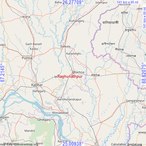
Raghunāthpur GPS coordinates[2]
25° 38' 41.712" North, 87° 55' 3.432" East
| Map corner | latitude | longitude |
|---|---|---|
| Upper-left | 26.27709°, | 87.2145° |
| Center: | 25.64492°, | 87.91762° |
| Lower-right: | 25.00938°, | 88.62075° |
| Map W x H: | 141×141 km | = 87.6×87.6mi |
| max Lat: | 34.9274° ⇑31.9% North |
| Raghunāthpur: | 25.64492° |
| min Lat: | ⇓68.1% South 8.09008° |
| min Long | Raghunāthpur | max Long |
| 68.82655° | 87.91762° | 96.81° |
| W 91%⇐ | ⇒9% E |
Elevation
Elevation of Raghunāthpur is 38 m = 125 ft, and this is 257.6 m = 845 ft below average elevation for this country.
| Max E: |
3681 m = 12077 ft | 82.6% |
| Avg. | 295.6 m = 970 ft | |
| Raghunāthpur | 38 m = 125 ft | |
Min E: |
1 m = 3 ft | 17.4% |
See also: India elevation on elevation.city.
Geographical zone
Raghunāthpur is located in North temperate zone (between Tropic of Cancer and the Arctic Circle). Distance of this Northern Tropic circle is 245.5 km =152.5 mi to South.| Distance of | km | miles | from Raghunāthpur |
|---|---|---|---|
| North Pole | 7155.6 | 4446.3 | to North |
| Arctic Circle | 4549.7 | 2827.1 | to North |
| Tropic Cancer | 245.5 | 152.5 | to South |
| Equator | 2851.4 | 1771.8 | to South |


Nearby cities:
15 places around Raghunāthpur: (largest is in red/bold)
• Arāria
69.2 km =43 mi,  324°
324°
• Bahādurganj
69.2 km =43 mi,  352°
352°
• Baisi
29.8 km =18.5 mi, 324°
• Dalkola
26.8 km =16.7 mi,  343°
343°
• Daulatpur
54.5 km =33.9 mi,  130°
130°
• Gangārāmpur
67.1 km =41.7 mi,  113°
113°
• Kasba
44.7 km =27.8 mi,  301°
301°
• Katihar
36.8 km =22.9 mi,  251°
251°
• Kishanganj
51 km =31.7 mi,  4°
4°
• Kāliyāganj
41 km =25.5 mi,  91°
91°
• Manihāri
45.3 km =28.1 mi,  221°
221°
• Purnia
46.9 km =29.1 mi,  288°
288°
• Rāiganj
21 km =13 mi,  99°
99°
• Rājmahal
66.4 km =41.3 mi,  187°
187°
• Sāhibganj
52.8 km =32.8 mi,  212°
212°
Sources, notices
• [Note1] Compared only with cities in India existing in our database
• [Src1] Map data: © OpenStreetMap contributors (CC-BY-SA)
• [Src2] Other city data from geonames.org with taken over terms of usage.
• [Src3] Geographical zone / Annual Mean Temperature by Robert A. Rohde @ Wikipedia
