Sāhibganj geodata
Sāhibganj (Jharkhand) is a populated place; located in India in Asia/Kolkata (GMT+5.5) time zone. With population of 95,890 people, there are 464 cities with bigger population in this country. Compared to other cities in India, 64.8% of cities are located further ↓South; 90.5% of cities are located further ←West and 81.1% of cities have higher elevation than Sāhibganj. Note1


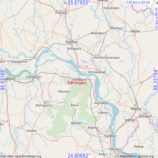
Sāhibganj GPS coordinates[2]
25° 14' 39.3" North, 87° 38' 5.316" East
| Map corner | latitude | longitude |
|---|---|---|
| Upper-left | 25.87855°, | 86.93169° |
| Center: | 25.24425°, | 87.63481° |
| Lower-right: | 24.60662°, | 88.33794° |
| Map W x H: | 141.4×141.4 km | = 87.9×87.9mi |
| max Lat: | 34.9274° ⇑35.2% North |
| Sāhibganj: | 25.24425° |
| min Lat: | ⇓64.8% South 8.09008° |
| min Long | Sāhibganj | max Long |
| 68.82655° | 87.63481° | 96.81° |
| W 90.5%⇐ | ⇒9.5% E |
Elevation
Elevation of Sāhibganj is 44 m = 144 ft, and this is 251.6 m = 825 ft below average elevation for this country.
| Max E: |
3681 m = 12077 ft | 81.1% |
| Avg. | 295.6 m = 970 ft | |
| Sāhibganj | 44 m = 144 ft | |
Min E: |
1 m = 3 ft | 18.9% |
See also: Sāhibganj elevation on elevation.city.
Geographical zone
Sāhibganj is located in North temperate zone (between Tropic of Cancer and the Arctic Circle). Distance of this Northern Tropic circle is 201 km =124.9 mi to South.| Distance of | km | miles | from Sāhibganj |
|---|---|---|---|
| North Pole | 7200.2 | 4474 | to North |
| Arctic Circle | 4594.3 | 2854.8 | to North |
| Tropic Cancer | 201 | 124.9 | to South |
| Equator | 2806.9 | 1744.1 | to South |


Nearby cities:
15 places around Sāhibganj: (largest is in red/bold)
• Bhāgalpur
66.7 km =41.4 mi,  270°
270°
• Colgong
40.5 km =25.2 mi, 272°
• Farakka
54.5 km =33.9 mi,  150°
150°
• Ghoga
48.1 km =29.9 mi, 266°
• Godda
62.9 km =39.1 mi,  222°
222°
• Ingrāj Bāzār
57.9 km =36 mi,  117°
117°
• Kasba
68.8 km =42.8 mi,  351°
351°
• Katihar
33.4 km =20.8 mi, 348°
• Manihāri
10.6 km =6.6 mi, 351°
• Naugachhia
56.2 km =34.9 mi,  286°
286°
• Paikpara
60.1 km =37.3 mi, 151°
• Purnia
61.6 km =38.3 mi,  344°
344°
• Raghunāthpur
52.8 km =32.8 mi,  32°
32°
• Rāiganj
64 km =39.8 mi,  50°
50°
• Rājmahal
29 km =18 mi,  137°
137°
Sources, notices
• [Note1] Compared only with cities in India existing in our database
• [Src1] Map data: © OpenStreetMap contributors (CC-BY-SA)
• [Src2] Other city data from geonames.org with taken over terms of usage.
• [Src3] Geographical zone / Annual Mean Temperature by Robert A. Rohde @ Wikipedia
