Keshorai Pātan geodata
Keshorai Pātan (Rajasthan) is a populated place; located in India in Asia/Kolkata (GMT+5.5) time zone. With population of 23,464 people, there are 1805 cities with bigger population in this country. Compared to other cities in India, 65.2% of cities are located further ↓South; 74.2% of cities are located further →East and 60.4% of cities have lower elevation than Keshorai Pātan. Note1


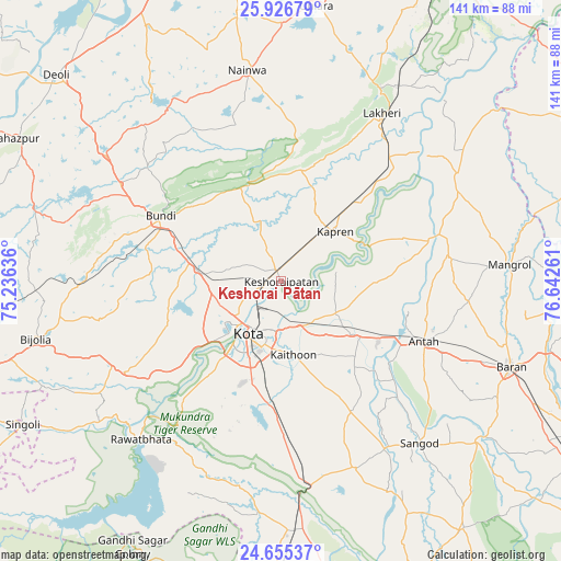
Keshorai Pātan GPS coordinates[2]
25° 17' 33.9" North, 75° 56' 22.128" East
| Map corner | latitude | longitude |
|---|---|---|
| Upper-left | 25.92679°, | 75.23636° |
| Center: | 25.29275°, | 75.93948° |
| Lower-right: | 24.65537°, | 76.64261° |
| Map W x H: | 141.4×141.4 km | = 87.9×87.9mi |
| max Lat: | 34.9274° ⇑34.8% North |
| Keshorai Pātan: | 25.29275° |
| min Lat: | ⇓65.2% South 8.09008° |
| min Long | Keshorai Pātan | max Long |
| 68.82655° | 75.93948° | 96.81° |
| W 25.8%⇐ | ⇒74.2% E |
Elevation
Elevation of Keshorai Pātan is 254 m = 833 ft, and this is 41.6 m = 136 ft below average elevation for this country.
| Max E: |
3681 m = 12077 ft | 39.6% |
| Avg. | 295.6 m = 970 ft | |
| Keshorai Pātan | 254 m = 833 ft | |
Min E: |
1 m = 3 ft | 60.4% |
See also: India elevation on elevation.city.
Geographical zone
Keshorai Pātan is located in North temperate zone (between Tropic of Cancer and the Arctic Circle). Distance of this Northern Tropic circle is 206.4 km =128.3 mi to South.| Distance of | km | miles | from Keshorai Pātan |
|---|---|---|---|
| North Pole | 7194.8 | 4470.6 | to North |
| Arctic Circle | 4588.9 | 2851.4 | to North |
| Tropic Cancer | 206.4 | 128.3 | to South |
| Equator | 2812.3 | 1747.5 | to South |


Nearby cities:
15 places around Keshorai Pātan: (largest is in red/bold)
• Anta
39.6 km =24.6 mi,  113°
113°
• Borkhera
39.3 km =24.4 mi,  310°
310°
• Bārān
61.9 km =38.5 mi, 110°
• Būndi
34.4 km =21.4 mi,  298°
298°
• Chechat
58.8 km =36.5 mi,  185°
185°
• Kota
15.9 km =9.9 mi,  219°
219°
• Kāpren
18.4 km =11.4 mi,  47°
47°
• Lākheri
48.5 km =30.1 mi,  29°
29°
• Māngrol
57.5 km =35.7 mi,  85°
85°
• Nainwa
54 km =33.6 mi,  350°
350°
• Rāmganj Mandi
71.9 km =44.7 mi,  179°
179°
• Rāwatbhāta
53.4 km =33.2 mi, 220°
• Sangod
53.6 km =33.3 mi,  139°
139°
• Suket
72.6 km =45.1 mi,  171°
171°
• Udpura
62.3 km =38.7 mi, 176°
Sources, notices
• [Note1] Compared only with cities in India existing in our database
• [Src1] Map data: © OpenStreetMap contributors (CC-BY-SA)
• [Src2] Other city data from geonames.org with taken over terms of usage.
• [Src3] Geographical zone / Annual Mean Temperature by Robert A. Rohde @ Wikipedia
