Anta geodata
Anta (Rajasthan) is a populated place; located in India in Asia/Kolkata (GMT+5.5) time zone. With population of 30,598 people, there are 1420 cities with bigger population in this country. Compared to other cities in India, 64.2% of cities are located further ↓South; 70.6% of cities are located further →East and 59.8% of cities have lower elevation than Anta. Note1


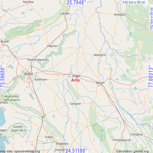
Anta GPS coordinates[2]
25° 9' 0" North, 76° 18' 0" East
| Map corner | latitude | longitude |
|---|---|---|
| Upper-left | 25.7848°, | 75.59688° |
| Center: | 25.15°, | 76.3° |
| Lower-right: | 24.51188°, | 77.00313° |
| Map W x H: | 141.5×141.5 km | = 87.9×87.9mi |
| max Lat: | 34.9274° ⇑35.8% North |
| Anta: | 25.15° |
| min Lat: | ⇓64.2% South 8.09008° |
| min Long | Anta | max Long |
| 68.82655° | 76.3° | 96.81° |
| W 29.4%⇐ | ⇒70.6% E |
Elevation
Elevation of Anta is 249 m = 817 ft, and this is 46.6 m = 153 ft below average elevation for this country.
| Max E: |
3681 m = 12077 ft | 40.2% |
| Avg. | 295.6 m = 970 ft | |
| Anta | 249 m = 817 ft | |
Min E: |
1 m = 3 ft | 59.8% |
See also: India elevation on elevation.city.
Geographical zone
Anta is located in North temperate zone (between Tropic of Cancer and the Arctic Circle). Distance of this Northern Tropic circle is 190.5 km =118.4 mi to South.| Distance of | km | miles | from Anta |
|---|---|---|---|
| North Pole | 7210.6 | 4480.5 | to North |
| Arctic Circle | 4604.8 | 2861.3 | to North |
| Tropic Cancer | 190.5 | 118.4 | to South |
| Equator | 2796.4 | 1737.6 | to South |


Nearby cities:
15 places around Anta: (largest is in red/bold)
• Bārān
22.5 km =14 mi,  104°
104°
• Chechat
59.8 km =37.2 mi,  224°
224°
• Jhālrapātan
68.8 km =42.8 mi,  190°
190°
• Jhālāwār
63.1 km =39.2 mi, 192°
• Keshorai Pātan
39.6 km =24.6 mi,  293°
293°
• Khānpur
47.4 km =29.5 mi,  168°
168°
• Kota
46.5 km =28.9 mi,  274°
274°
• Kāpren
36.3 km =22.6 mi,  321°
321°
• Lākheri
59.4 km =36.9 mi,  347°
347°
• Māngrol
29.1 km =18.1 mi,  46°
46°
• Rāmganj Mandi
66.6 km =41.4 mi,  212°
212°
• Sangod
24.8 km =15.4 mi,  183°
183°
• Sheopur
69.7 km =43.3 mi,  34°
34°
• Suket
61.8 km =38.4 mi,  204°
204°
• Udpura
56.7 km =35.2 mi, 215°
Sources, notices
• [Note1] Compared only with cities in India existing in our database
• [Src1] Map data: © OpenStreetMap contributors (CC-BY-SA)
• [Src2] Other city data from geonames.org with taken over terms of usage.
• [Src3] Geographical zone / Annual Mean Temperature by Robert A. Rohde @ Wikipedia
