Bisenda Buzurg geodata
Bisenda Buzurg (Uttar Pradesh) is a populated place; located in India in Asia/Kolkata (GMT+5.5) time zone. With population of 11,100 people, there are 2824 cities with bigger population in this country. Compared to other cities in India, 66.1% of cities are located further ↓South; 71.5% of cities are located further ←West and 62.7% of cities have higher elevation than Bisenda Buzurg. Note1


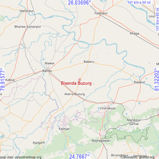
Bisenda Buzurg GPS coordinates[2]
25° 24' 12.6" North, 80° 37' 8.004" East
| Map corner | latitude | longitude |
|---|---|---|
| Upper-left | 26.03696°, | 79.91577° |
| Center: | 25.4035°, | 80.61889° |
| Lower-right: | 24.7667°, | 81.32202° |
| Map W x H: | 141.2×141.2 km | = 87.7×87.7mi |
| max Lat: | 34.9274° ⇑33.9% North |
| Bisenda Buzurg: | 25.4035° |
| min Lat: | ⇓66.1% South 8.09008° |
| min Long | Bisenda Buzurg | max Long |
| 68.82655° | 80.61889° | 96.81° |
| W 71.5%⇐ | ⇒28.5% E |
Elevation
Elevation of Bisenda Buzurg is 134 m = 440 ft, and this is 161.6 m = 530 ft below average elevation for this country.
| Max E: |
3681 m = 12077 ft | 62.7% |
| Avg. | 295.6 m = 970 ft | |
| Bisenda Buzurg | 134 m = 440 ft | |
Min E: |
1 m = 3 ft | 37.3% |
See also: India elevation on elevation.city.
Geographical zone
Bisenda Buzurg is located in North temperate zone (between Tropic of Cancer and the Arctic Circle). Distance of this Northern Tropic circle is 218.7 km =135.9 mi to South.| Distance of | km | miles | from Bisenda Buzurg |
|---|---|---|---|
| North Pole | 7182.5 | 4463 | to North |
| Arctic Circle | 4576.6 | 2843.8 | to North |
| Tropic Cancer | 218.7 | 135.9 | to South |
| Equator | 2824.6 | 1755.1 | to South |


Nearby cities:
15 places around Bisenda Buzurg: (largest is in red/bold)
• Atarra
13.9 km =8.6 mi,  200°
200°
• Baberu
18.1 km =11.2 mi,  28°
28°
• Bahua
48.5 km =30.1 mi,  0°
0°
• Bānda
29.7 km =18.5 mi,  286°
286°
• Chandla
56.6 km =35.2 mi,  229°
229°
• Fatehpur
61.4 km =38.2 mi,  18°
18°
• Kabrāi
62.2 km =38.6 mi,  269°
269°
• Kishanpur
48.4 km =30.1 mi,  56°
56°
• Mataundh
46.6 km =29 mi, 274°
• Maudaha
59.4 km =36.9 mi,  301°
301°
• Mānikpur
61.6 km =38.3 mi,  128°
128°
• Naraini
27.8 km =17.3 mi,  211°
211°
• Oran
13 km =8.1 mi,  107°
107°
• Rājāpur
53.5 km =33.2 mi,  91°
91°
• Tindwāri
25.5 km =15.8 mi,  338°
338°
Sources, notices
• [Note1] Compared only with cities in India existing in our database
• [Src1] Map data: © OpenStreetMap contributors (CC-BY-SA)
• [Src2] Other city data from geonames.org with taken over terms of usage.
• [Src3] Geographical zone / Annual Mean Temperature by Robert A. Rohde @ Wikipedia
