Bīkāpur geodata
Bīkāpur (Uttar Pradesh) is a populated place; located in India in Asia/Kolkata (GMT+5.5) time zone. With population of 13,177 people, there are 2638 cities with bigger population in this country. Compared to other cities in India, 75.4% of cities are located further ↓South; 77% of cities are located further ←West and 67.4% of cities have higher elevation than Bīkāpur. Note1


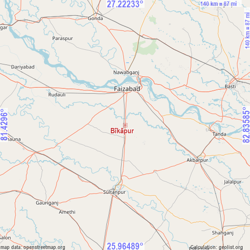
Bīkāpur GPS coordinates[2]
26° 35' 43.224" North, 82° 7' 57.792" East
| Map corner | latitude | longitude |
|---|---|---|
| Upper-left | 27.22233°, | 81.4296° |
| Center: | 26.59534°, | 82.13272° |
| Lower-right: | 25.96489°, | 82.83585° |
| Map W x H: | 139.8×139.8 km | = 86.9×86.9mi |
| max Lat: | 34.9274° ⇑24.6% North |
| Bīkāpur: | 26.59534° |
| min Lat: | ⇓75.4% South 8.09008° |
| min Long | Bīkāpur | max Long |
| 68.82655° | 82.13272° | 96.81° |
| W 77%⇐ | ⇒23% E |
Elevation
Elevation of Bīkāpur is 105 m = 344 ft, and this is 190.6 m = 625 ft below average elevation for this country.
| Max E: |
3681 m = 12077 ft | 67.4% |
| Avg. | 295.6 m = 970 ft | |
| Bīkāpur | 105 m = 344 ft | |
Min E: |
1 m = 3 ft | 32.6% |
See also: India elevation on elevation.city.
Geographical zone
Bīkāpur is located in North temperate zone (between Tropic of Cancer and the Arctic Circle). Distance of this Northern Tropic circle is 351.2 km =218.2 mi to South.| Distance of | km | miles | from Bīkāpur |
|---|---|---|---|
| North Pole | 7049.9 | 4380.6 | to North |
| Arctic Circle | 4444 | 2761.4 | to North |
| Tropic Cancer | 351.2 | 218.2 | to South |
| Equator | 2957.1 | 1837.5 | to South |


Nearby cities:
15 places around Bīkāpur: (largest is in red/bold)
• Ajodhya
23.8 km =14.8 mi,  17°
17°
• Akbarpur
44 km =27.3 mi,  114°
114°
• Amethī
58.7 km =36.5 mi,  213°
213°
• Bastī
61.8 km =38.4 mi,  69°
69°
• Dostpur
49 km =30.4 mi,  136°
136°
• Fyzābād
20.1 km =12.5 mi,  4°
4°
• Gondā City
62.2 km =38.6 mi,  343°
343°
• Goshāinganj
24.8 km =15.4 mi,  96°
96°
• Haraiya
39.7 km =24.7 mi,  56°
56°
• Kādīpur
53.1 km =33 mi,  153°
153°
• Mankāpur
51.7 km =32.1 mi,  10°
10°
• Musāfir-Khāna
41.3 km =25.7 mi,  234°
234°
• Nawābganj
29.9 km =18.6 mi, 1°
• Sultānpur
38 km =23.6 mi,  189°
189°
• Tāndā
52.5 km =32.6 mi, 95°
Sources, notices
• [Note1] Compared only with cities in India existing in our database
• [Src1] Map data: © OpenStreetMap contributors (CC-BY-SA)
• [Src2] Other city data from geonames.org with taken over terms of usage.
• [Src3] Geographical zone / Annual Mean Temperature by Robert A. Rohde @ Wikipedia
