Barghāt geodata
Barghāt (Madhya Pradesh) is a populated place; located in India in Asia/Kolkata (GMT+5.5) time zone. With population of 11,219 people, there are 2811 cities with bigger population in this country. Compared to other cities in India, 56.6% of cities are located further ↑North; 65.9% of cities are located further ←West and 84.3% of cities have lower elevation than Barghāt. Note1


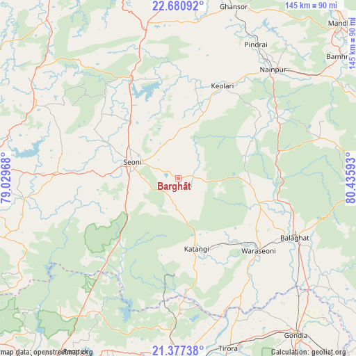
Barghāt GPS coordinates[2]
22° 1' 50.34" North, 79° 43' 58.08" East
| Map corner | latitude | longitude |
|---|---|---|
| Upper-left | 22.68092°, | 79.02968° |
| Center: | 22.03065°, | 79.7328° |
| Lower-right: | 21.37738°, | 80.43593° |
| Map W x H: | 144.9×144.9 km | = 90×90mi |
| max Lat: | 34.9274° ⇑56.6% North |
| Barghāt: | 22.03065° |
| min Lat: | ⇓43.4% South 8.09008° |
| min Long | Barghāt | max Long |
| 68.82655° | 79.7328° | 96.81° |
| W 65.9%⇐ | ⇒34.1% E |
Elevation
Elevation of Barghāt is 538 m = 1765 ft, and this is 242.4 m = 795 ft above average elevation for this country.
| Max E: |
3681 m = 12077 ft | 15.7% |
| Barghāt | 538 m 1765 ft | |
| Avg. | 295.6 m = 970 ft | |
Min E: |
1 m = 3 ft | 84.3% |
See also: India elevation on elevation.city.
Geographical zone
Barghāt is located in North Torrid zone (between Equator and Tropic of Cancer). Distance of this Northern Tropic circle is 156.3 km =97.1 mi to North.| Distance of | km | miles | from Barghāt |
|---|---|---|---|
| North Pole | 7557.5 | 4696 | to North |
| Arctic Circle | 4951.6 | 3076.8 | to North |
| Tropic Cancer | 156.3 | 97.1 | to North |
| Equator | 2449.6 | 1522.1 | to South |


Nearby cities:
15 places around Barghāt: (largest is in red/bold)
• Amarwāra
65.2 km =40.5 mi,  297°
297°
• Bālāghāt
52.7 km =32.7 mi,  116°
116°
• Chhindwāra
81.8 km =50.8 mi,  272°
272°
• Chicholi
62.5 km =38.8 mi,  182°
182°
• Ghansor
73.4 km =45.6 mi,  17°
17°
• Gondiā
79.2 km =49.2 mi,  143°
143°
• Hīrāpur Hamesha
53.1 km =33 mi,  174°
174°
• Katangi
29.5 km =18.3 mi, 165°
• Lakhnādon
64.8 km =40.3 mi,  347°
347°
• Nainpur
58.7 km =36.5 mi,  40°
40°
• Seoni
19.7 km =12.2 mi,  287°
287°
• Tirodi
38.4 km =23.9 mi, 182°
• Tumsar
72 km =44.7 mi, 179°
• Ukwā
75.9 km =47.2 mi,  95°
95°
• Wārāseonī
43.8 km =27.2 mi,  133°
133°
Sources, notices
• [Note1] Compared only with cities in India existing in our database
• [Src1] Map data: © OpenStreetMap contributors (CC-BY-SA)
• [Src2] Other city data from geonames.org with taken over terms of usage.
• [Src3] Geographical zone / Annual Mean Temperature by Robert A. Rohde @ Wikipedia
