Hīrāpur Hamesha geodata
Hīrāpur Hamesha (Maharashtra) is a populated place; located in India in Asia/Kolkata (GMT+5.5) time zone. With population of 6,069 people, there are 3287 cities with bigger population in this country. Compared to other cities in India, 58.7% of cities are located further ↑North; 66.3% of cities are located further ←West and 66.6% of cities have lower elevation than Hīrāpur Hamesha. Note1


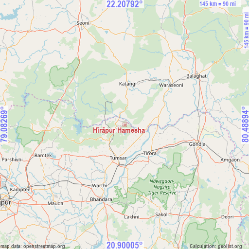
Hīrāpur Hamesha GPS coordinates[2]
21° 33' 19.656" North, 79° 47' 8.916" East
| Map corner | latitude | longitude |
|---|---|---|
| Upper-left | 22.20792°, | 79.08269° |
| Center: | 21.55546°, | 79.78581° |
| Lower-right: | 20.90005°, | 80.48894° |
| Map W x H: | 145.4×145.4 km | = 90.3×90.3mi |
| max Lat: | 34.9274° ⇑58.7% North |
| Hīrāpur Hamesha: | 21.55546° |
| min Lat: | ⇓41.3% South 8.09008° |
| min Long | Hīrāpur Hames | max Long |
| 68.82655° | 79.78581° | 96.81° |
| W 66.3%⇐ | ⇒33.7% E |
Elevation
Elevation of Hīrāpur Hamesha is 299 m = 981 ft, and this is 3.4 m = 11 ft above average elevation for this country.
| Max E: |
3681 m = 12077 ft | 33.4% |
| Hīrāpur Hamesha | 299 m 981 ft | |
| Avg. | 295.6 m = 970 ft | |
Min E: |
1 m = 3 ft | 66.6% |
See also: India elevation on elevation.city.
Geographical zone
Hīrāpur Hamesha is located in North Torrid zone (between Equator and Tropic of Cancer). Distance of this Northern Tropic circle is 209.2 km =130 mi to North.| Distance of | km | miles | from Hīrāpur Hamesha |
|---|---|---|---|
| North Pole | 7610.3 | 4728.8 | to North |
| Arctic Circle | 5004.4 | 3109.6 | to North |
| Tropic Cancer | 209.2 | 130 | to North |
| Equator | 2396.7 | 1489.2 | to South |


Nearby cities:
15 places around Hīrāpur Hamesha: (largest is in red/bold)
• Barghāt
53.1 km =33 mi,  354°
354°
• Bhandāra
45.3 km =28.1 mi,  198°
198°
• Bālāghāt
50.7 km =31.5 mi,  55°
55°
• Chicholi
13 km =8.1 mi,  222°
222°
• Gondiā
43.3 km =26.9 mi,  104°
104°
• Katangi
24.3 km =15.1 mi,  4°
4°
• Korādi
78.3 km =48.7 mi,  244°
244°
• Kāmthi
71.7 km =44.6 mi, 238°
• Kāndri
54.8 km =34.1 mi,  254°
254°
• Mansar
56.9 km =35.4 mi, 251°
• Rāmtek
50.7 km =31.5 mi, 249°
• Seoni
63.7 km =39.6 mi,  337°
337°
• Tirodi
16 km =9.9 mi,  334°
334°
• Tumsar
19.9 km =12.4 mi, 195°
• Wārāseonī
35.1 km =21.8 mi,  49°
49°
Sources, notices
• [Note1] Compared only with cities in India existing in our database
• [Src1] Map data: © OpenStreetMap contributors (CC-BY-SA)
• [Src2] Other city data from geonames.org with taken over terms of usage.
• [Src3] Geographical zone / Annual Mean Temperature by Robert A. Rohde @ Wikipedia
