Tumsar geodata
Tumsar (Maharashtra) is a populated place; located in India in Asia/Kolkata (GMT+5.5) time zone. With population of 43,218 people, there are 1023 cities with bigger population in this country. Compared to other cities in India, 59.6% of cities are located further ↑North; 65.9% of cities are located further ←West and 63.9% of cities have lower elevation than Tumsar. Note1


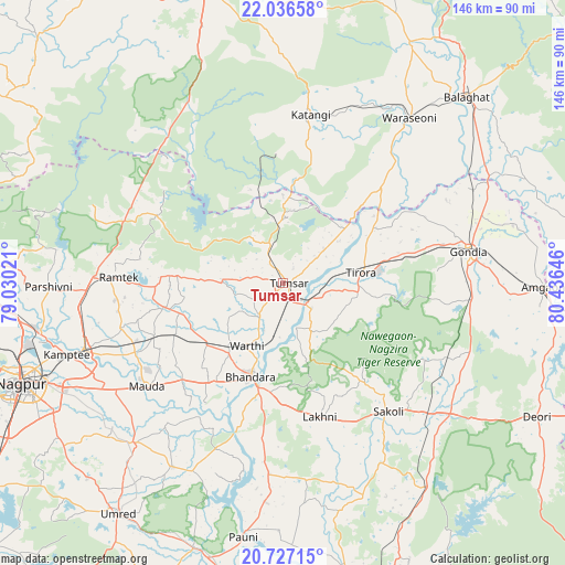
Tumsar GPS coordinates[2]
21° 22' 59.988" North, 79° 43' 59.988" East
| Map corner | latitude | longitude |
|---|---|---|
| Upper-left | 22.03658°, | 79.03021° |
| Center: | 21.38333°, | 79.73333° |
| Lower-right: | 20.72715°, | 80.43646° |
| Map W x H: | 145.6×145.6 km | = 90.5×90.5mi |
| max Lat: | 34.9274° ⇑59.6% North |
| Tumsar: | 21.38333° |
| min Lat: | ⇓40.4% South 8.09008° |
| min Long | Tumsar | max Long |
| 68.82655° | 79.73333° | 96.81° |
| W 65.9%⇐ | ⇒34.1% E |
Elevation
Elevation of Tumsar is 278 m = 912 ft, and this is 17.6 m = 58 ft below average elevation for this country.
| Max E: |
3681 m = 12077 ft | 36.1% |
| Avg. | 295.6 m = 970 ft | |
| Tumsar | 278 m = 912 ft | |
Min E: |
1 m = 3 ft | 63.9% |
See also: Tumsar elevation on elevation.city.
Geographical zone
Tumsar is located in North Torrid zone (between Equator and Tropic of Cancer). Distance of this Northern Tropic circle is 228.3 km =141.9 mi to North.| Distance of | km | miles | from Tumsar |
|---|---|---|---|
| North Pole | 7629.5 | 4740.8 | to North |
| Arctic Circle | 5023.6 | 3121.5 | to North |
| Tropic Cancer | 228.3 | 141.9 | to North |
| Equator | 2377.6 | 1477.4 | to South |


Nearby cities:
15 places around Tumsar: (largest is in red/bold)
• Barghāt
72 km =44.7 mi,  359°
359°
• Bhandāra
25.5 km =15.8 mi,  200°
200°
• Bālāghāt
67.3 km =41.8 mi,  44°
44°
• Chicholi
10.1 km =6.3 mi,  340°
340°
• Gondiā
48.2 km =30 mi,  79°
79°
• Hīrāpur Hamesha
19.9 km =12.4 mi,  15°
15°
• Katangi
44 km =27.3 mi,  9°
9°
• Korādi
66.7 km =41.4 mi,  256°
256°
• Kāmthi
58.6 km =36.4 mi,  251°
251°
• Kāndri
47.5 km =29.5 mi,  274°
274°
• Mansar
48.7 km =30.3 mi, 271°
• Pawni
66.5 km =41.3 mi,  188°
188°
• Rāmtek
42.1 km =26.2 mi, 271°
• Tirodi
33.6 km =20.9 mi, 357°
• Wārāseonī
52.9 km =32.9 mi, 37°
Sources, notices
• [Note1] Compared only with cities in India existing in our database
• [Src1] Map data: © OpenStreetMap contributors (CC-BY-SA)
• [Src2] Other city data from geonames.org with taken over terms of usage.
• [Src3] Geographical zone / Annual Mean Temperature by Robert A. Rohde @ Wikipedia
