Chhindwāra geodata
Chhindwāra (Madhya Pradesh) is a populated place; located in India in Asia/Kolkata (GMT+5.5) time zone. With population of 134,847 people, there are 321 cities with bigger population in this country. Compared to other cities in India, 56.4% of cities are located further ↑North; 58.5% of cities are located further ←West and 92.1% of cities have lower elevation than Chhindwāra. Note1


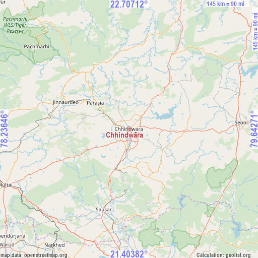
Chhindwāra GPS coordinates[2]
22° 3' 25.092" North, 78° 56' 22.488" East
| Map corner | latitude | longitude |
|---|---|---|
| Upper-left | 22.70712°, | 78.23646° |
| Center: | 22.05697°, | 78.93958° |
| Lower-right: | 21.40382°, | 79.64271° |
| Map W x H: | 144.9×144.9 km | = 90×90mi |
| max Lat: | 34.9274° ⇑56.4% North |
| Chhindwāra: | 22.05697° |
| min Lat: | ⇓43.6% South 8.09008° |
| min Long | Chhindwāra | max Long |
| 68.82655° | 78.93958° | 96.81° |
| W 58.5%⇐ | ⇒41.5% E |
Elevation
Elevation of Chhindwāra is 688 m = 2257 ft, and this is 392.4 m = 1287 ft above average elevation for this country.
| Max E: |
3681 m = 12077 ft | 7.9% |
| Chhindwāra | 688 m 2257 ft | |
| Avg. | 295.6 m = 970 ft | |
Min E: |
1 m = 3 ft | 92.1% |
See also: Chhindwāra elevation on elevation.city.
Geographical zone
Chhindwāra is located in North Torrid zone (between Equator and Tropic of Cancer). Distance of this Northern Tropic circle is 153.4 km =95.3 mi to North.| Distance of | km | miles | from Chhindwāra |
|---|---|---|---|
| North Pole | 7554.6 | 4694.2 | to North |
| Arctic Circle | 4948.7 | 3075 | to North |
| Tropic Cancer | 153.4 | 95.3 | to North |
| Equator | 2452.5 | 1523.9 | to South |


Nearby cities:
15 places around Chhindwāra: (largest is in red/bold)
• Amarwāra
35.7 km =22.2 mi,  41°
41°
• Harrai
68.4 km =42.5 mi,  25°
25°
• Jāmai
39 km =24.2 mi,  293°
293°
• Khāpa
70.7 km =43.9 mi,  176°
176°
• Kāndri
78.9 km =49 mi,  153°
153°
• Lodhīkheda
53.4 km =33.2 mi,  188°
188°
• Mohgaon
50.9 km =31.6 mi,  204°
204°
• Multai
77 km =47.8 mi,  245°
245°
• Pachmarhi
69.3 km =43.1 mi,  311°
311°
• Panara
43.3 km =26.9 mi, 292°
• Parāsia
23.9 km =14.9 mi, 308°
• Pāndhurnā
66.7 km =41.4 mi,  219°
219°
• Saoner
74.7 km =46.4 mi, 181°
• Sausar
47 km =29.2 mi, 198°
• Seoni
63 km =39.1 mi,  87°
87°
Sources, notices
• [Note1] Compared only with cities in India existing in our database
• [Src1] Map data: © OpenStreetMap contributors (CC-BY-SA)
• [Src2] Other city data from geonames.org with taken over terms of usage.
• [Src3] Geographical zone / Annual Mean Temperature by Robert A. Rohde @ Wikipedia
