Chicholi geodata
Chicholi (Maharashtra) is a populated place; located in India in Asia/Kolkata (GMT+5.5) time zone. With population of 18,864 people, there are 2138 cities with bigger population in this country. Compared to other cities in India, 59.1% of cities are located further ↑North; 65.7% of cities are located further ←West and 65.7% of cities have lower elevation than Chicholi. Note1


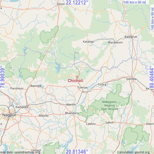
Chicholi GPS coordinates[2]
21° 28' 9.336" North, 79° 42' 5.436" East
| Map corner | latitude | longitude |
|---|---|---|
| Upper-left | 22.12212°, | 78.99839° |
| Center: | 21.46926°, | 79.70151° |
| Lower-right: | 20.81346°, | 80.40464° |
| Map W x H: | 145.5×145.5 km | = 90.4×90.4mi |
| max Lat: | 34.9274° ⇑59.1% North |
| Chicholi: | 21.46926° |
| min Lat: | ⇓40.9% South 8.09008° |
| min Long | Chicholi | max Long |
| 68.82655° | 79.70151° | 96.81° |
| W 65.7%⇐ | ⇒34.3% E |
Elevation
Elevation of Chicholi is 291 m = 955 ft, and this is 4.6 m = 15 ft below average elevation for this country.
| Max E: |
3681 m = 12077 ft | 34.3% |
| Avg. | 295.6 m = 970 ft | |
| Chicholi | 291 m = 955 ft | |
Min E: |
1 m = 3 ft | 65.7% |
See also: India elevation on elevation.city.
Geographical zone
Chicholi is located in North Torrid zone (between Equator and Tropic of Cancer). Distance of this Northern Tropic circle is 218.8 km =136 mi to North.| Distance of | km | miles | from Chicholi |
|---|---|---|---|
| North Pole | 7619.9 | 4734.8 | to North |
| Arctic Circle | 5014 | 3115.6 | to North |
| Tropic Cancer | 218.8 | 136 | to North |
| Equator | 2387.2 | 1483.3 | to South |


Nearby cities:
15 places around Chicholi: (largest is in red/bold)
• Barghāt
62.5 km =38.8 mi,  2°
2°
• Bhandāra
33.9 km =21.1 mi,  189°
189°
• Bālāghāt
63.4 km =39.4 mi,  52°
52°
• Gondiā
50.8 km =31.6 mi,  91°
91°
• Hīrāpur Hamesha
13 km =8.1 mi,  42°
42°
• Katangi
35.5 km =22.1 mi,  17°
17°
• Korādi
66.4 km =41.3 mi,  248°
248°
• Kāmthi
59.3 km =36.8 mi,  241°
241°
• Kāndri
44.3 km =27.5 mi,  262°
262°
• Mansar
46.1 km =28.6 mi, 259°
• Rāmtek
39.6 km =24.6 mi, 258°
• Seoni
70.2 km =43.6 mi,  347°
347°
• Tirodi
24.1 km =15 mi, 4°
• Tumsar
10.1 km =6.3 mi,  160°
160°
• Wārāseonī
48 km =29.8 mi, 47°
Sources, notices
• [Note1] Compared only with cities in India existing in our database
• [Src1] Map data: © OpenStreetMap contributors (CC-BY-SA)
• [Src2] Other city data from geonames.org with taken over terms of usage.
• [Src3] Geographical zone / Annual Mean Temperature by Robert A. Rohde @ Wikipedia
