Bangaon geodata
Bangaon (Bihar) is a populated place; located in India in Asia/Kolkata (GMT+5.5) time zone. With population of 60,000 people, there are 732 cities with bigger population in this country. Compared to other cities in India, 69.4% of cities are located further ↓South; 88.2% of cities are located further ←West and 79.2% of cities have higher elevation than Bangaon. Note1


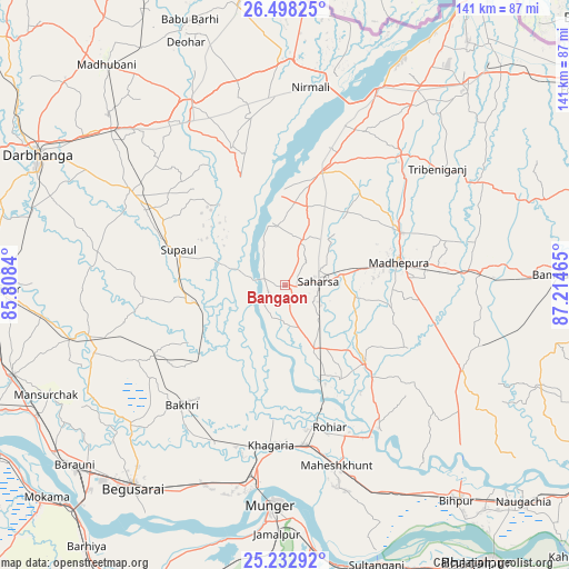
Bangaon GPS coordinates[2]
25° 52' 2.208" North, 86° 30' 41.472" East
| Map corner | latitude | longitude |
|---|---|---|
| Upper-left | 26.49825°, | 85.8084° |
| Center: | 25.86728°, | 86.51152° |
| Lower-right: | 25.23292°, | 87.21465° |
| Map W x H: | 140.7×140.7 km | = 87.4×87.4mi |
| max Lat: | 34.9274° ⇑30.6% North |
| Bangaon: | 25.86728° |
| min Lat: | ⇓69.4% South 8.09008° |
| min Long | Bangaon | max Long |
| 68.82655° | 86.51152° | 96.81° |
| W 88.2%⇐ | ⇒11.8% E |
Elevation
Elevation of Bangaon is 51 m = 167 ft, and this is 244.6 m = 802 ft below average elevation for this country.
| Max E: |
3681 m = 12077 ft | 79.2% |
| Avg. | 295.6 m = 970 ft | |
| Bangaon | 51 m = 167 ft | |
Min E: |
1 m = 3 ft | 20.8% |
See also: Bangaon elevation on elevation.city.
Geographical zone
Bangaon is located in North temperate zone (between Tropic of Cancer and the Arctic Circle). Distance of this Northern Tropic circle is 270.3 km =168 mi to South.| Distance of | km | miles | from Bangaon |
|---|---|---|---|
| North Pole | 7130.9 | 4430.9 | to North |
| Arctic Circle | 4525 | 2811.7 | to North |
| Tropic Cancer | 270.3 | 168 | to South |
| Equator | 2876.2 | 1787.2 | to South |


Nearby cities:
15 places around Bangaon: (largest is in red/bold)
• Bariārpur
64.7 km =40.2 mi,  174°
174°
• Begusarai
62.6 km =38.9 mi,  217°
217°
• Bhagirathpur
63.3 km =39.3 mi,  314°
314°
• Bihārīganj
50 km =31.1 mi,  107°
107°
• Chhātāpur
63 km =39.1 mi,  51°
51°
• Jamālpur
61.7 km =38.3 mi,  182°
182°
• Jhanjhārpur
49.9 km =31 mi,  332°
332°
• Khagaria
40.8 km =25.4 mi,  186°
186°
• Madhipura
28.8 km =17.9 mi,  77°
77°
• Monghyr
54.9 km =34.1 mi, 183°
• Murlīganj
48.6 km =30.2 mi,  86°
86°
• Nirmāli
50.2 km =31.2 mi,  8°
8°
• Rusera
50.2 km =31.2 mi,  255°
255°
• Saharsa
8.5 km =5.3 mi, 84°
• Supaul
28.8 km =17.9 mi,  16°
16°
Sources, notices
• [Note1] Compared only with cities in India existing in our database
• [Src1] Map data: © OpenStreetMap contributors (CC-BY-SA)
• [Src2] Other city data from geonames.org with taken over terms of usage.
• [Src3] Geographical zone / Annual Mean Temperature by Robert A. Rohde @ Wikipedia
