Kheri Sāmpla geodata
Kheri Sāmpla (Haryana) is a populated place; located in India in Asia/Kolkata (GMT+5.5) time zone. With population of 10,891 people, there are 2844 cities with bigger population in this country. Compared to other cities in India, 88.2% of cities are located further ↓South; 65.4% of cities are located further →East and 54.2% of cities have lower elevation than Kheri Sāmpla. Note1


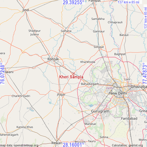
Kheri Sāmpla GPS coordinates[2]
28° 46' 41.16" North, 76° 46' 32.16" East
| Map corner | latitude | longitude |
|---|---|---|
| Upper-left | 29.39255°, | 76.07248° |
| Center: | 28.7781°, | 76.7756° |
| Lower-right: | 28.16001°, | 77.47873° |
| Map W x H: | 137×137 km | = 85.1×85.1mi |
| max Lat: | 34.9274° ⇑11.8% North |
| Kheri Sāmpla: | 28.7781° |
| min Lat: | ⇓88.2% South 8.09008° |
| min Long | Kheri Sāmpla | max Long |
| 68.82655° | 76.7756° | 96.81° |
| W 34.6%⇐ | ⇒65.4% E |
Elevation
Elevation of Kheri Sāmpla is 223 m = 732 ft, and this is 72.6 m = 238 ft below average elevation for this country.
| Max E: |
3681 m = 12077 ft | 45.8% |
| Avg. | 295.6 m = 970 ft | |
| Kheri Sāmpla | 223 m = 732 ft | |
Min E: |
1 m = 3 ft | 54.2% |
See also: India elevation on elevation.city.
Geographical zone
Kheri Sāmpla is located in North temperate zone (between Tropic of Cancer and the Arctic Circle). Distance of this Northern Tropic circle is 593.9 km =369 mi to South.| Distance of | km | miles | from Kheri Sāmpla |
|---|---|---|---|
| North Pole | 6807.2 | 4229.8 | to North |
| Arctic Circle | 4201.3 | 2610.6 | to North |
| Tropic Cancer | 593.9 | 369 | to South |
| Equator | 3199.8 | 1988.3 | to South |


Nearby cities:
15 places around Kheri Sāmpla: (largest is in red/bold)
• Alīpur
34.9 km =21.7 mi,  86°
86°
• Bahādurgarh
18.2 km =11.3 mi,  121°
121°
• Bawāna
25.3 km =15.7 mi,  84°
84°
• Beri Khās
21.1 km =13.1 mi,  246°
246°
• Farrukhnagar
37.1 km =23.1 mi,  172°
172°
• Jhajjar
22.4 km =13.9 mi,  211°
211°
• Kalānaur
37.5 km =23.3 mi,  278°
278°
• Kharkhauda
17.3 km =10.7 mi,  49°
49°
• Najafgarh
27.4 km =17 mi,  133°
133°
• Narela
32 km =19.9 mi,  74°
74°
• Nāngloi Jāt
30.5 km =19 mi,  111°
111°
• Pitampura
36 km =22.4 mi, 105°
• Rohini
28.7 km =17.8 mi,  97°
97°
• Rohtak
22.3 km =13.9 mi,  305°
305°
• Sonīpat
33.8 km =21 mi,  44°
44°
Sources, notices
• [Note1] Compared only with cities in India existing in our database
• [Src1] Map data: © OpenStreetMap contributors (CC-BY-SA)
• [Src2] Other city data from geonames.org with taken over terms of usage.
• [Src3] Geographical zone / Annual Mean Temperature by Robert A. Rohde @ Wikipedia
