Ar Ruţbah geodata
Ar Ruţbah (Anbar) is a seat of a second-order administrative division; located in Iraq in Asia/Baghdad (GMT+3) time zone. With population of 22,370 people, there are 65 cities with bigger population in this country. Compared to other cities in Iraq, 64.8% of cities are located further ↑North; 100% of cities are located further →East and 83.1% of cities have lower elevation than Ar Ruţbah. Note1


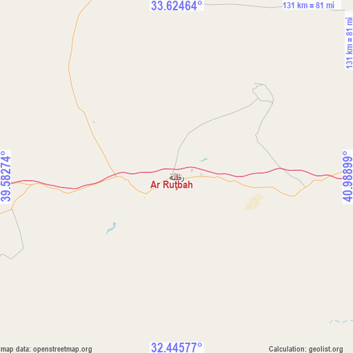
Ar Ruţbah GPS coordinates[2]
33° 2' 13.848" North, 40° 17' 9.096" East
| Map corner | latitude | longitude |
|---|---|---|
| Upper-left | 33.62464°, | 39.58274° |
| Center: | 33.03718°, | 40.28586° |
| Lower-right: | 32.44577°, | 40.98899° |
| Map W x H: | 131.1×131.1 km | = 81.5×81.5mi |
| max Lat: | 37.22781° ⇑64.8% North |
| Ar Ruţbah: | 33.03718° |
| min Lat: | ⇓35.2% South 29.97421° |
| min Long | Ar Ruţbah | max Long |
| 40.28586° | 40.28586° | 48.47309° |
| W 0%⇐ | ⇒100% E |
Elevation
Elevation of Ar Ruţbah is 620 m = 2034 ft, and this is 327 m = 1073 ft above average elevation for this country.
| Max E: |
1316 m = 4318 ft | 16.9% |
| Ar Ruţbah | 620 m 2034 ft | |
| Avg. | 293 m = 961 ft | |
Min E: |
1 m = 3 ft | 83.1% |
See also: Iraq elevation on elevation.city.
Geographical zone
Ar Ruţbah is located in North temperate zone (between Tropic of Cancer and the Arctic Circle). Distance of this Northern Tropic circle is 1067.5 km =663.3 mi to South.| Distance of | km | miles | from Ar Ruţbah |
|---|---|---|---|
| North Pole | 6333.7 | 3935.6 | to North |
| Arctic Circle | 3727.8 | 2316.3 | to North |
| Tropic Cancer | 1067.5 | 663.3 | to South |
| Equator | 3673.4 | 2282.5 | to South |


Nearby cities:
15 places around Ar Ruţbah: (largest is in red/bold)
• Al Ba‘āj
358.9 km =223 mi,  21°
21°
• Al Fallūjah
327.5 km =203.5 mi,  83°
83°
• Al Qā’im
164.1 km =102 mi, 23°
• Al Ḩaqlānīyah
224.9 km =139.7 mi,  58°
58°
• Al ‘Awjah
359.4 km =223.3 mi, 62°
• Hīt
245.3 km =152.4 mi,  74°
74°
• Karbala
352.5 km =219 mi,  97°
97°
• Ramadi
284.3 km =176.7 mi, 81°
• Rāwah
220.5 km =137 mi,  43°
43°
• Sāmarrā’
357.3 km =222 mi, 68°
• Tikrīt
359.2 km =223.2 mi, 60°
• Ḩadīthah
229.1 km =142.4 mi, 57°
• ‘Anah
215.7 km =134 mi,  46°
46°
• ‘Anat al Qadīmah
220.9 km =137.3 mi, 43°
• ‘Ayn Tamr
303.8 km =188.8 mi, 99°
Sources, notices
• [Note1] Compared only with cities in Iraq existing in our database
• [Src1] Map data: © OpenStreetMap contributors (CC-BY-SA)
• [Src2] Other city data from geonames.org with taken over terms of usage.
• [Src3] Geographical zone / Annual Mean Temperature by Robert A. Rohde @ Wikipedia
