Mandalī geodata
Mandalī (Diyālá) is a populated place; located in Iraq in Asia/Baghdad (GMT+3) time zone. With population of 29,785 people, there are 55 cities with bigger population in this country. Compared to other cities in Iraq, 57.7% of cities are located further ↑North; 77.5% of cities are located further ←West and 50% of cities have lower elevation than Mandalī. Note1


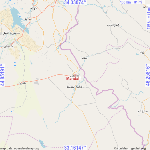
Mandalī GPS coordinates[2]
33° 44' 53.16" North, 45° 33' 18.108" East
| Map corner | latitude | longitude |
|---|---|---|
| Upper-left | 34.33074°, | 44.85191° |
| Center: | 33.7481°, | 45.55503° |
| Lower-right: | 33.16147°, | 46.25816° |
| Map W x H: | 130×130 km | = 80.8×80.8mi |
| max Lat: | 37.22781° ⇑57.7% North |
| Mandalī: | 33.7481° |
| min Lat: | ⇓42.3% South 29.97421° |
| min Long | Mandalī | max Long |
| 40.28586° | 45.55503° | 48.47309° |
| W 77.5%⇐ | ⇒22.5% E |
Elevation
Elevation of Mandalī is 129 m = 423 ft, and this is 164 m = 538 ft below average elevation for this country.
| Max E: |
1316 m = 4318 ft | 50% |
| Avg. | 293 m = 961 ft | |
| Mandalī | 129 m = 423 ft | |
Min E: |
1 m = 3 ft | 50% |
See also: Iraq elevation on elevation.city.
Geographical zone
Mandalī is located in North temperate zone (between Tropic of Cancer and the Arctic Circle). Distance of this Northern Tropic circle is 1146.5 km =712.4 mi to South.| Distance of | km | miles | from Mandalī |
|---|---|---|---|
| North Pole | 6254.6 | 3886.4 | to North |
| Arctic Circle | 3648.7 | 2267.2 | to North |
| Tropic Cancer | 1146.5 | 712.4 | to South |
| Equator | 3752.4 | 2331.6 | to South |


Nearby cities:
15 places around Mandalī: (largest is in red/bold)
• Ad Dujayl
122.5 km =76.1 mi,  275°
275°
• Al Khāliş
96.3 km =59.8 mi, 276°
• Al Miqdādīyah
62.6 km =38.9 mi,  294°
294°
• Al ‘Azīzīyah
103.8 km =64.5 mi,  206°
206°
• An Nu‘mānīyah
133.2 km =82.8 mi,  185°
185°
• Aş Şuwayrah
116.6 km =72.5 mi,  218°
218°
• Aţ Ţārmīyah
107.5 km =66.8 mi,  265°
265°
• Badrah
78.7 km =48.9 mi,  153°
153°
• Baghdad
116.2 km =72.2 mi,  247°
247°
• Baladrūz
44.5 km =27.7 mi,  262°
262°
• Baqubah
87.8 km =54.6 mi, 270°
• Kelar
100.2 km =62.3 mi,  347°
347°
• Khāliş
94.7 km =58.8 mi, 274°
• Khānaqīn
68.4 km =42.5 mi, 347°
• Kifrī
118.1 km =73.4 mi,  332°
332°
Sources, notices
• [Note1] Compared only with cities in Iraq existing in our database
• [Src1] Map data: © OpenStreetMap contributors (CC-BY-SA)
• [Src2] Other city data from geonames.org with taken over terms of usage.
• [Src3] Geographical zone / Annual Mean Temperature by Robert A. Rohde @ Wikipedia
