Baladrūz geodata
Baladrūz (Diyālá) is a seat of a second-order administrative division; located in Iraq in Asia/Baghdad (GMT+3) time zone. In our database, there are 71 cities with bigger population. Compared to other cities in Iraq, 58.5% of cities are located further ↑North; 68.3% of cities are located further ←West and 64.1% of cities have higher elevation than Baladrūz. Note1


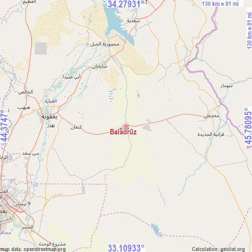
Baladrūz GPS coordinates[2]
33° 41' 46.716" North, 45° 4' 40.152" East
| Map corner | latitude | longitude |
|---|---|---|
| Upper-left | 34.27931°, | 44.3747° |
| Center: | 33.69631°, | 45.07782° |
| Lower-right: | 33.10933°, | 45.78095° |
| Map W x H: | 130.1×130.1 km | = 80.8×80.8mi |
| max Lat: | 37.22781° ⇑58.5% North |
| Baladrūz: | 33.69631° |
| min Lat: | ⇓41.5% South 29.97421° |
| min Long | Baladrūz | max Long |
| 40.28586° | 45.07782° | 48.47309° |
| W 68.3%⇐ | ⇒31.7% E |
Elevation
Elevation of Baladrūz is 42 m = 138 ft, and this is 251 m = 823 ft below average elevation for this country.
| Max E: |
1316 m = 4318 ft | 64.1% |
| Avg. | 293 m = 961 ft | |
| Baladrūz | 42 m = 138 ft | |
Min E: |
1 m = 3 ft | 35.9% |
See also: Iraq elevation on elevation.city.
Geographical zone
Baladrūz is located in North temperate zone (between Tropic of Cancer and the Arctic Circle). Distance of this Northern Tropic circle is 1140.8 km =708.9 mi to South.| Distance of | km | miles | from Baladrūz |
|---|---|---|---|
| North Pole | 6260.4 | 3890 | to North |
| Arctic Circle | 3654.5 | 2270.8 | to North |
| Tropic Cancer | 1140.8 | 708.9 | to South |
| Equator | 3746.7 | 2328.1 | to South |


Nearby cities:
15 places around Baladrūz: (largest is in red/bold)
• Abū Ghurayb
93.5 km =58.1 mi,  242°
242°
• Ad Dujayl
79.7 km =49.5 mi,  282°
282°
• Al Khāliş
54.3 km =33.7 mi,  288°
288°
• Al Maḩmūdīyah
96.7 km =60.1 mi,  223°
223°
• Al Miqdādīyah
34 km =21.1 mi,  337°
337°
• Al ‘Azīzīyah
87.5 km =54.4 mi,  180°
180°
• Aş Şuwayrah
90.2 km =56 mi,  198°
198°
• Aţ Ţārmīyah
63.1 km =39.2 mi,  267°
267°
• Badrah
102.4 km =63.6 mi,  129°
129°
• Baghdad
74.2 km =46.1 mi, 237°
• Balad
93.1 km =57.8 mi, 292°
• Baqubah
44.2 km =27.5 mi, 278°
• Khāliş
51.8 km =32.2 mi, 283°
• Khānaqīn
78 km =48.5 mi,  21°
21°
• Mandalī
44.5 km =27.7 mi,  82°
82°
Sources, notices
• [Note1] Compared only with cities in Iraq existing in our database
• [Src1] Map data: © OpenStreetMap contributors (CC-BY-SA)
• [Src2] Other city data from geonames.org with taken over terms of usage.
• [Src3] Geographical zone / Annual Mean Temperature by Robert A. Rohde @ Wikipedia
