Ad Dujayl geodata
Ad Dujayl (Salah ad Din) is a populated place; located in Iraq in Asia/Baghdad (GMT+3) time zone. With population of 26,362 people, there are 58 cities with bigger population in this country. Compared to other cities in Iraq, 55.6% of cities are located further ↑North; 60.6% of cities are located further →East and 61.3% of cities have higher elevation than Ad Dujayl. Note1


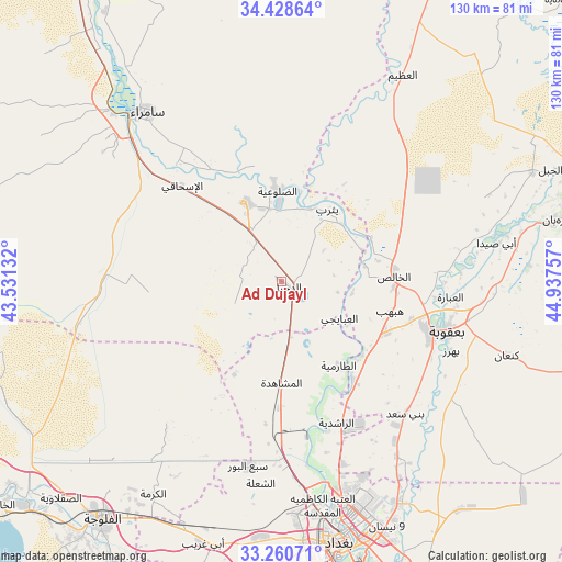
Ad Dujayl GPS coordinates[2]
33° 50' 48.012" North, 44° 14' 3.984" East
| Map corner | latitude | longitude |
|---|---|---|
| Upper-left | 34.42864°, | 43.53132° |
| Center: | 33.84667°, | 44.23444° |
| Lower-right: | 33.26071°, | 44.93757° |
| Map W x H: | 129.9×129.9 km | = 80.7×80.7mi |
| max Lat: | 37.22781° ⇑55.6% North |
| Ad Dujayl: | 33.84667° |
| min Lat: | ⇓44.4% South 29.97421° |
| min Long | Ad Dujayl | max Long |
| 40.28586° | 44.23444° | 48.47309° |
| W 39.4%⇐ | ⇒60.6% E |
Elevation
Elevation of Ad Dujayl is 46 m = 151 ft, and this is 247 m = 810 ft below average elevation for this country.
| Max E: |
1316 m = 4318 ft | 61.3% |
| Avg. | 293 m = 961 ft | |
| Ad Dujayl | 46 m = 151 ft | |
Min E: |
1 m = 3 ft | 38.7% |
See also: Iraq elevation on elevation.city.
Geographical zone
Ad Dujayl is located in North temperate zone (between Tropic of Cancer and the Arctic Circle). Distance of this Northern Tropic circle is 1157.5 km =719.2 mi to South.| Distance of | km | miles | from Ad Dujayl |
|---|---|---|---|
| North Pole | 6243.7 | 3879.7 | to North |
| Arctic Circle | 3637.8 | 2260.4 | to North |
| Tropic Cancer | 1157.5 | 719.2 | to South |
| Equator | 3763.4 | 2338.5 | to South |


Nearby cities:
15 places around Ad Dujayl: (largest is in red/bold)
• Abū Ghurayb
60.3 km =37.5 mi,  184°
184°
• Ad Dawr
79 km =49.1 mi,  329°
329°
• Al Fallūjah
69.2 km =43 mi,  216°
216°
• Al Khāliş
26.4 km =16.4 mi,  88°
88°
• Al Maḩmūdīyah
88.1 km =54.7 mi,  172°
172°
• Al Miqdādīyah
66.5 km =41.3 mi,  77°
77°
• Al ‘Awjah
89.2 km =55.4 mi, 328°
• Aţ Ţārmīyah
24.3 km =15.1 mi,  142°
142°
• Baghdad
58.3 km =36.2 mi,  164°
164°
• Balad
20.4 km =12.7 mi,  336°
336°
• Baladrūz
79.7 km =49.5 mi,  102°
102°
• Baqubah
35.8 km =22.2 mi,  106°
106°
• Khāliş
27.9 km =17.3 mi, 98°
• Ramadi
98 km =60.9 mi,  241°
241°
• Sāmarrā’
50.4 km =31.3 mi,  320°
320°
Sources, notices
• [Note1] Compared only with cities in Iraq existing in our database
• [Src1] Map data: © OpenStreetMap contributors (CC-BY-SA)
• [Src2] Other city data from geonames.org with taken over terms of usage.
• [Src3] Geographical zone / Annual Mean Temperature by Robert A. Rohde @ Wikipedia
