Seyah Cheshmeh geodata
Seyah Cheshmeh (West Azerbaijan) is a seat of a second-order administrative division; located in Iran in Asia/Tehran (GMT+3.5) time zone. In our database, there are 232 cities with bigger population. Compared to other cities in Iran, 98.6% of cities are located further ↓South; 100% of cities are located further →East and 88% of cities have lower elevation than Seyah Cheshmeh. Note1


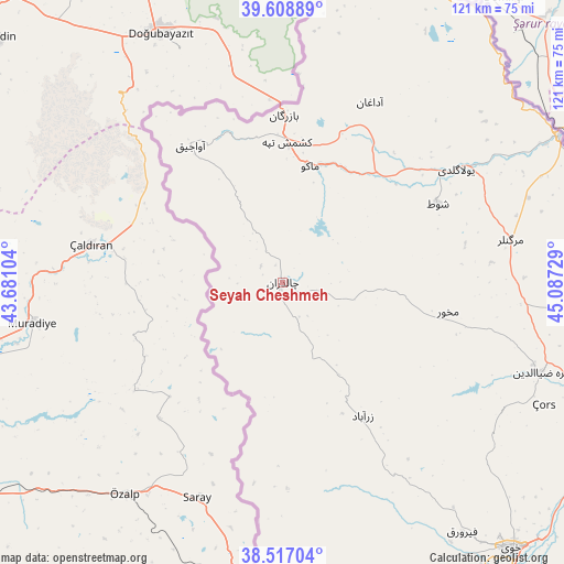
Seyah Cheshmeh GPS coordinates[2]
39° 3' 54.288" North, 44° 23' 2.976" East
| Map corner | latitude | longitude |
|---|---|---|
| Upper-left | 39.60889°, | 43.68104° |
| Center: | 39.06508°, | 44.38416° |
| Lower-right: | 38.51704°, | 45.08729° |
| Map W x H: | 121.4×121.4 km | = 75.4×75.4mi |
| max Lat: | 39.6482° ⇑1.4% North |
| Seyah Cheshmeh: | 39.06508° |
| min Lat: | ⇓98.6% South 25.2919° |
| min Long | Seyah Cheshmeh | max Long |
| 44.38416° | 44.38416° | 61.9965° |
| W 0%⇐ | ⇒100% E |
Elevation
Elevation of Seyah Cheshmeh is 1832 m = 6010 ft, and this is 783 m = 2569 ft above average elevation for this country.
| Max E: |
2564 m = 8412 ft | 12% |
| Seyah Cheshmeh | 1832 m 6010 ft | |
| Avg. | 1049 m = 3442 ft | |
Min E: |
-24 m = -79 ft | 88% |
See also: Iran elevation on elevation.city.
Geographical zone
Seyah Cheshmeh is located in North temperate zone (between Tropic of Cancer and the Arctic Circle). Distance of this Northern Tropic circle is 1737.7 km =1079.8 mi to South.| Distance of | km | miles | from Seyah Cheshmeh |
|---|---|---|---|
| North Pole | 5663.4 | 3519.1 | to North |
| Arctic Circle | 3057.5 | 1899.8 | to North |
| Tropic Cancer | 1737.7 | 1079.8 | to South |
| Equator | 4343.6 | 2699 | to South |


Nearby cities:
15 places around Seyah Cheshmeh: (largest is in red/bold)
• Kandovān
215.2 km =133.7 mi,  131°
131°
• Khowy
75.5 km =46.9 mi,  139°
139°
• Maku
25.8 km =16 mi,  14°
14°
• Marand
139.6 km =86.7 mi,  120°
120°
• Mīāb
129.2 km =80.3 mi,  108°
108°
• Orūmīyeh
178.7 km =111 mi,  160°
160°
• Oskū
198.1 km =123.1 mi, 130°
• Poldasht
67 km =41.6 mi,  62°
62°
• Qarah Ẕīā’ od Dīn
58.7 km =36.5 mi, 109°
• Salmās
102 km =63.4 mi, 161°
• Shabestar
151 km =93.8 mi, 130°
• Showţ
37.4 km =23.2 mi, 62°
• Tabriz
198.7 km =123.5 mi, 123°
• Varazqān
155.7 km =96.7 mi, 106°
• Āz̄arshahr
200.9 km =124.8 mi, 136°
Sources, notices
• [Note1] Compared only with cities in Iran existing in our database
• [Src1] Map data: © OpenStreetMap contributors (CC-BY-SA)
• [Src2] Other city data from geonames.org with taken over terms of usage.
• [Src3] Geographical zone / Annual Mean Temperature by Robert A. Rohde @ Wikipedia
