Qarah Ẕīā’ od Dīn geodata
Qarah Ẕīā’ od Dīn (West Azerbaijan) is a seat of a second-order administrative division; located in Iran in Asia/Tehran (GMT+3.5) time zone. With population of 31,947 people, there are 172 cities with bigger population in this country. Compared to other cities in Iran, 98.2% of cities are located further ↓South; 98.9% of cities are located further →East and 54% of cities have higher elevation than Qarah Ẕīā’ od Dīn. Note1


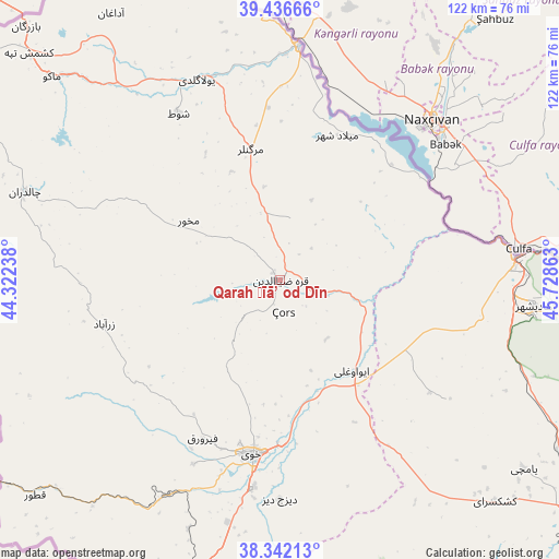
Qarah Ẕīā’ od Dīn GPS coordinates[2]
38° 53' 29.4" North, 45° 1' 31.8" East
| Map corner | latitude | longitude |
|---|---|---|
| Upper-left | 39.43666°, | 44.32238° |
| Center: | 38.8915°, | 45.0255° |
| Lower-right: | 38.34213°, | 45.72863° |
| Map W x H: | 121.7×121.7 km | = 75.6×75.6mi |
| max Lat: | 39.6482° ⇑1.8% North |
| Qarah Ẕīā’ od Dīn: | 38.8915° |
| min Lat: | ⇓98.2% South 25.2919° |
| min Long | Qarah Ẕīā� | max Long |
| 44.38416° | 45.0255° | 61.9965° |
| W 1.1%⇐ | ⇒98.9% E |
Elevation
Elevation of Qarah Ẕīā’ od Dīn is 1090 m = 3576 ft, and this is 41 m = 135 ft above average elevation for this country.
| Max E: |
2564 m = 8412 ft | 54% |
| Qarah Ẕīā’ od Dīn | 1090 m 3576 ft | |
| Avg. | 1049 m = 3442 ft | |
Min E: |
-24 m = -79 ft | 46% |
See also: Iran elevation on elevation.city.
Geographical zone
Qarah Ẕīā’ od Dīn is located in North temperate zone (between Tropic of Cancer and the Arctic Circle). Distance of this Northern Tropic circle is 1718.4 km =1067.8 mi to South.| Distance of | km | miles | from Qarah Ẕīā’ od Dīn |
|---|---|---|---|
| North Pole | 5682.7 | 3531.1 | to North |
| Arctic Circle | 3076.8 | 1911.8 | to North |
| Tropic Cancer | 1718.4 | 1067.8 | to South |
| Equator | 4324.3 | 2687 | to South |


Nearby cities:
15 places around Qarah Ẕīā’ od Dīn: (largest is in red/bold)
• Kandovān
162 km =100.7 mi,  138°
138°
• Khowy
38.5 km =23.9 mi,  189°
189°
• Maku
65.9 km =40.9 mi,  312°
312°
• Marand
82.7 km =51.4 mi,  128°
128°
• Mīāb
70.5 km =43.8 mi,  107°
107°
• Orūmīyeh
148.9 km =92.5 mi,  178°
178°
• Oskū
144.7 km =89.9 mi, 138°
• Poldasht
50.9 km =31.6 mi,  4°
4°
• Salmās
80.4 km =50 mi,  196°
196°
• Seyah Cheshmeh
58.7 km =36.5 mi,  289°
289°
• Shabestar
98.6 km =61.3 mi, 143°
• Showţ
42.6 km =26.5 mi,  328°
328°
• Tabriz
142.4 km =88.5 mi, 129°
• Varazqān
97.2 km =60.4 mi,  104°
104°
• Āz̄arshahr
150.9 km =93.8 mi,  146°
146°
Sources, notices
• [Note1] Compared only with cities in Iran existing in our database
• [Src1] Map data: © OpenStreetMap contributors (CC-BY-SA)
• [Src2] Other city data from geonames.org with taken over terms of usage.
• [Src3] Geographical zone / Annual Mean Temperature by Robert A. Rohde @ Wikipedia
