Poldasht geodata
Poldasht (West Azerbaijan) is a seat of a second-order administrative division; located in Iran in Asia/Tehran (GMT+3.5) time zone. In our database, there are 232 cities with bigger population. Compared to other cities in Iran, 99.5% of cities are located further ↓South; 98.6% of cities are located further →East and 67.3% of cities have higher elevation than Poldasht. Note1


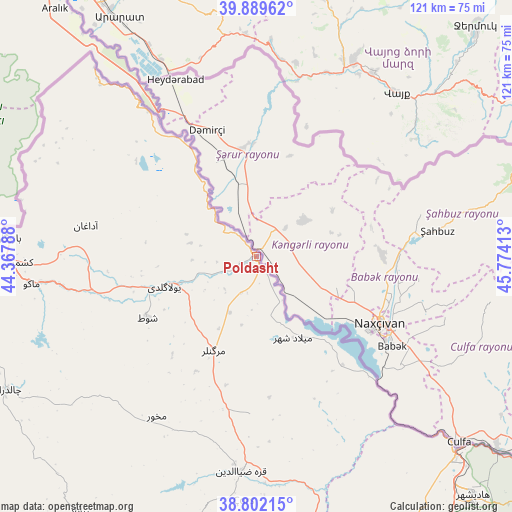
Poldasht GPS coordinates[2]
39° 20' 52.8" North, 45° 4' 15.6" East
| Map corner | latitude | longitude |
|---|---|---|
| Upper-left | 39.88962°, | 44.36788° |
| Center: | 39.348°, | 45.071° |
| Lower-right: | 38.80215°, | 45.77413° |
| Map W x H: | 120.9×120.9 km | = 75.1×75.1mi |
| max Lat: | 39.6482° ⇑0.5% North |
| Poldasht: | 39.348° |
| min Lat: | ⇓99.5% South 25.2919° |
| min Long | Poldasht | max Long |
| 44.38416° | 45.071° | 61.9965° |
| W 1.4%⇐ | ⇒98.6% E |
Elevation
Elevation of Poldasht is 783 m = 2569 ft, and this is 266 m = 873 ft below average elevation for this country.
| Max E: |
2564 m = 8412 ft | 67.3% |
| Avg. | 1049 m = 3442 ft | |
| Poldasht | 783 m = 2569 ft | |
Min E: |
-24 m = -79 ft | 32.7% |
See also: Iran elevation on elevation.city.
Geographical zone
Poldasht is located in North temperate zone (between Tropic of Cancer and the Arctic Circle). Distance of this Northern Tropic circle is 1769.2 km =1099.3 mi to South.| Distance of | km | miles | from Poldasht |
|---|---|---|---|
| North Pole | 5632 | 3499.6 | to North |
| Arctic Circle | 3026.1 | 1880.3 | to North |
| Tropic Cancer | 1769.2 | 1099.3 | to South |
| Equator | 4375.1 | 2718.6 | to South |


Nearby cities:
15 places around Poldasht: (largest is in red/bold)
• Kaleybar
178.1 km =110.7 mi,  107°
107°
• Khomārlū
170.5 km =105.9 mi,  97°
97°
• Khowy
89.3 km =55.5 mi,  186°
186°
• Maku
52.9 km =32.9 mi,  262°
262°
• Marand
118.6 km =73.7 mi,  149°
149°
• Mīāb
95.7 km =59.5 mi,  138°
138°
• Oskū
183.7 km =114.1 mi, 150°
• Qarah Ẕīā’ od Dīn
50.9 km =31.6 mi,  184°
184°
• Salmās
130.7 km =81.2 mi, 191°
• Seyah Cheshmeh
67 km =41.6 mi,  242°
242°
• Shabestar
140.9 km =87.6 mi,  157°
157°
• Showţ
29.6 km =18.4 mi, 241°
• Tabriz
176.3 km =109.5 mi, 143°
• Varazqān
117 km =72.7 mi,  129°
129°
• Āz̄arshahr
193.5 km =120.2 mi, 155°
Sources, notices
• [Note1] Compared only with cities in Iran existing in our database
• [Src1] Map data: © OpenStreetMap contributors (CC-BY-SA)
• [Src2] Other city data from geonames.org with taken over terms of usage.
• [Src3] Geographical zone / Annual Mean Temperature by Robert A. Rohde @ Wikipedia
