Marvdasht geodata
Marvdasht (Fars) is a seat of a second-order administrative division; located in Iran in Asia/Tehran (GMT+3.5) time zone. With population of 148,858 people, there are 49 cities with bigger population in this country. Compared to other cities in Iran, 84.1% of cities are located further ↑North; 64.2% of cities are located further ←West and 77.1% of cities have lower elevation than Marvdasht. Note1


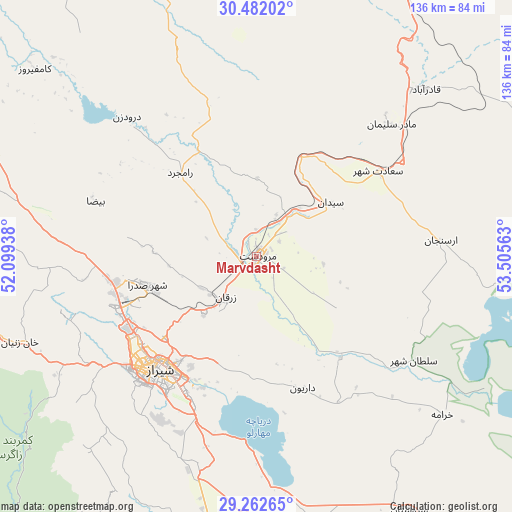
Marvdasht GPS coordinates[2]
29° 52' 27.12" North, 52° 48' 9" East
| Map corner | latitude | longitude |
|---|---|---|
| Upper-left | 30.48202°, | 52.09938° |
| Center: | 29.8742°, | 52.8025° |
| Lower-right: | 29.26265°, | 53.50563° |
| Map W x H: | 135.6×135.6 km | = 84.3×84.3mi |
| max Lat: | 39.6482° ⇑84.1% North |
| Marvdasht: | 29.8742° |
| min Lat: | ⇓15.9% South 25.2919° |
| min Long | Marvdasht | max Long |
| 44.38416° | 52.8025° | 61.9965° |
| W 64.2%⇐ | ⇒35.8% E |
Elevation
Elevation of Marvdasht is 1603 m = 5259 ft, and this is 554 m = 1818 ft above average elevation for this country.
| Max E: |
2564 m = 8412 ft | 22.9% |
| Marvdasht | 1603 m 5259 ft | |
| Avg. | 1049 m = 3442 ft | |
Min E: |
-24 m = -79 ft | 77.1% |
See also: Marvdasht elevation on elevation.city.
Geographical zone
Marvdasht is located in North temperate zone (between Tropic of Cancer and the Arctic Circle). Distance of this Northern Tropic circle is 715.8 km =444.8 mi to South.| Distance of | km | miles | from Marvdasht |
|---|---|---|---|
| North Pole | 6685.4 | 4154.1 | to North |
| Arctic Circle | 4079.5 | 2534.9 | to North |
| Tropic Cancer | 715.8 | 444.8 | to South |
| Equator | 3321.7 | 2064 | to South |


Nearby cities:
15 places around Marvdasht: (largest is in red/bold)
• Akbarābād
69.8 km =43.4 mi,  181°
181°
• Arsanjān
49 km =30.4 mi,  85°
85°
• Eqlīd
114.4 km =71.1 mi,  354°
354°
• Fīrūzābād
116.8 km =72.6 mi,  191°
191°
• Kavār
75.2 km =46.7 mi, 188°
• Kherāmeh
64.5 km =40.1 mi,  130°
130°
• Kāzerūn
114.5 km =71.1 mi,  255°
255°
• Nūrābād
126.2 km =78.4 mi,  282°
282°
• Pāsārgād
51.5 km =32 mi,  44°
44°
• Sarvestān
78.1 km =48.5 mi,  148°
148°
• Sa‘ādat Shahr
39.3 km =24.4 mi,  54°
54°
• Sepīdān
89.7 km =55.7 mi,  298°
298°
• Shiraz
39.3 km =24.4 mi,  221°
221°
• Sūrīān
104 km =64.6 mi, 51°
• Şafāshahr
90.4 km =56.2 mi,  24°
24°
Sources, notices
• [Note1] Compared only with cities in Iran existing in our database
• [Src1] Map data: © OpenStreetMap contributors (CC-BY-SA)
• [Src2] Other city data from geonames.org with taken over terms of usage.
• [Src3] Geographical zone / Annual Mean Temperature by Robert A. Rohde @ Wikipedia
