Arsanjān geodata
Arsanjān (Fars) is a seat of a second-order administrative division; located in Iran in Asia/Tehran (GMT+3.5) time zone. In our database, there are 232 cities with bigger population. Compared to other cities in Iran, 83.7% of cities are located further ↑North; 68.3% of cities are located further ←West and 79.1% of cities have lower elevation than Arsanjān. Note1


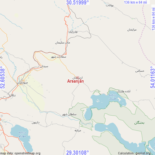
Arsanjān GPS coordinates[2]
29° 54' 44.64" North, 53° 18' 30.6" East
| Map corner | latitude | longitude |
|---|---|---|
| Upper-left | 30.51999°, | 52.60538° |
| Center: | 29.9124°, | 53.3085° |
| Lower-right: | 29.30108°, | 54.01163° |
| Map W x H: | 135.5×135.5 km | = 84.2×84.2mi |
| max Lat: | 39.6482° ⇑83.7% North |
| Arsanjān: | 29.9124° |
| min Lat: | ⇓16.3% South 25.2919° |
| min Long | Arsanjān | max Long |
| 44.38416° | 53.3085° | 61.9965° |
| W 68.3%⇐ | ⇒31.7% E |
Elevation
Elevation of Arsanjān is 1634 m = 5361 ft, and this is 585 m = 1919 ft above average elevation for this country.
| Max E: |
2564 m = 8412 ft | 20.9% |
| Arsanjān | 1634 m 5361 ft | |
| Avg. | 1049 m = 3442 ft | |
Min E: |
-24 m = -79 ft | 79.1% |
See also: Iran elevation on elevation.city.
Geographical zone
Arsanjān is located in North temperate zone (between Tropic of Cancer and the Arctic Circle). Distance of this Northern Tropic circle is 720 km =447.4 mi to South.| Distance of | km | miles | from Arsanjān |
|---|---|---|---|
| North Pole | 6681.1 | 4151.4 | to North |
| Arctic Circle | 4075.2 | 2532.2 | to North |
| Tropic Cancer | 720 | 447.4 | to South |
| Equator | 3325.9 | 2066.6 | to South |


Nearby cities:
15 places around Arsanjān: (largest is in red/bold)
• Akbarābād
90 km =55.9 mi,  214°
214°
• Eqlīd
124.4 km =77.3 mi,  331°
331°
• Estahbān
112.6 km =70 mi,  140°
140°
• Fasā
113.2 km =70.3 mi,  163°
163°
• Kavār
98.8 km =61.4 mi,  217°
217°
• Kherāmeh
46 km =28.6 mi,  179°
179°
• Marvdasht
49 km =30.4 mi,  265°
265°
• Neyrīz
126.5 km =78.6 mi,  128°
128°
• Pāsārgād
34.5 km =21.4 mi,  338°
338°
• Sarvestān
71.5 km =44.4 mi,  186°
186°
• Sa‘ādat Shahr
25 km =15.5 mi,  317°
317°
• Shahr-e Herāt
103.7 km =64.4 mi,  81°
81°
• Shiraz
82.2 km =51.1 mi,  245°
245°
• Sūrīān
68.7 km =42.7 mi,  28°
28°
• Şafāshahr
78.7 km =48.9 mi,  352°
352°
Sources, notices
• [Note1] Compared only with cities in Iran existing in our database
• [Src1] Map data: © OpenStreetMap contributors (CC-BY-SA)
• [Src2] Other city data from geonames.org with taken over terms of usage.
• [Src3] Geographical zone / Annual Mean Temperature by Robert A. Rohde @ Wikipedia
