Khalīlābād geodata
Khalīlābād (Razavi Khorasan) is a seat of a second-order administrative division; located in Iran in Asia/Tehran (GMT+3.5) time zone. In our database, there are 232 cities with bigger population. Compared to other cities in Iran, 59% of cities are located further ↓South; 89.3% of cities are located further ←West and 59.9% of cities have higher elevation than Khalīlābād. Note1


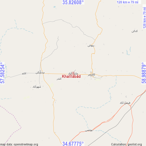
Khalīlābād GPS coordinates[2]
35° 15' 14.22" North, 58° 17' 8.376" East
| Map corner | latitude | longitude |
|---|---|---|
| Upper-left | 35.82608°, | 57.58254° |
| Center: | 35.25395°, | 58.28566° |
| Lower-right: | 34.67775°, | 58.98879° |
| Map W x H: | 127.7×127.7 km | = 79.3×79.3mi |
| max Lat: | 39.6482° ⇑41% North |
| Khalīlābād: | 35.25395° |
| min Lat: | ⇓59% South 25.2919° |
| min Long | Khalīlābād | max Long |
| 44.38416° | 58.28566° | 61.9965° |
| W 89.3%⇐ | ⇒10.7% E |
Elevation
Elevation of Khalīlābād is 980 m = 3215 ft, and this is 69 m = 226 ft below average elevation for this country.
| Max E: |
2564 m = 8412 ft | 59.9% |
| Avg. | 1049 m = 3442 ft | |
| Khalīlābād | 980 m = 3215 ft | |
Min E: |
-24 m = -79 ft | 40.1% |
See also: Iran elevation on elevation.city.
Geographical zone
Khalīlābād is located in North temperate zone (between Tropic of Cancer and the Arctic Circle). Distance of this Northern Tropic circle is 1314 km =816.5 mi to South.| Distance of | km | miles | from Khalīlābād |
|---|---|---|---|
| North Pole | 6087.2 | 3782.4 | to North |
| Arctic Circle | 3481.3 | 2163.2 | to North |
| Tropic Cancer | 1314 | 816.5 | to South |
| Equator | 3919.9 | 2435.7 | to South |


Nearby cities:
15 places around Khalīlābād: (largest is in red/bold)
• Bajestān
82.5 km =51.3 mi,  186°
186°
• Bardaskan
28.6 km =17.8 mi,  271°
271°
• Bozghān
117.9 km =73.3 mi,  13°
13°
• Dowlatābād
112.1 km =69.7 mi,  88°
88°
• Farīmān
150.3 km =93.4 mi,  70°
70°
• Ferdows
137.8 km =85.6 mi,  184°
184°
• Feyẕābād
52.3 km =32.5 mi,  120°
120°
• Gonābād
106.6 km =66.2 mi,  160°
160°
• Kāshmar
16.4 km =10.2 mi,  96°
96°
• Neyshābūr
116.2 km =72.2 mi,  23°
23°
• Roshtkhvār
125.7 km =78.1 mi, 104°
• Sabzevar
119.7 km =74.4 mi,  332°
332°
• Solţānābād
129.7 km =80.6 mi,  350°
350°
• Torbat-e Ḩeydarīyeh
84.8 km =52.7 mi, 88°
• Ţorqabeh
153.1 km =95.1 mi,  39°
39°
Sources, notices
• [Note1] Compared only with cities in Iran existing in our database
• [Src1] Map data: © OpenStreetMap contributors (CC-BY-SA)
• [Src2] Other city data from geonames.org with taken over terms of usage.
• [Src3] Geographical zone / Annual Mean Temperature by Robert A. Rohde @ Wikipedia
