Feyẕābād geodata
Feyẕābād (Razavi Khorasan) is a seat of a second-order administrative division; located in Iran in Asia/Tehran (GMT+3.5) time zone. In our database, there are 232 cities with bigger population. Compared to other cities in Iran, 56.5% of cities are located further ↓South; 91.2% of cities are located further ←West and 62.1% of cities have higher elevation than Feyẕābād. Note1


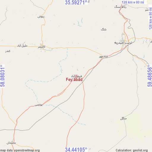
Feyẕābād GPS coordinates[2]
35° 1' 8.076" North, 58° 47' 0.348" East
| Map corner | latitude | longitude |
|---|---|---|
| Upper-left | 35.59271°, | 58.08031° |
| Center: | 35.01891°, | 58.78343° |
| Lower-right: | 34.44105°, | 59.48656° |
| Map W x H: | 128.1×128.1 km | = 79.6×79.6mi |
| max Lat: | 39.6482° ⇑43.5% North |
| Feyẕābād: | 35.01891° |
| min Lat: | ⇓56.5% South 25.2919° |
| min Long | Feyẕābād | max Long |
| 44.38416° | 58.78343° | 61.9965° |
| W 91.2%⇐ | ⇒8.8% E |
Elevation
Elevation of Feyẕābād is 931 m = 3054 ft, and this is 118 m = 387 ft below average elevation for this country.
| Max E: |
2564 m = 8412 ft | 62.1% |
| Avg. | 1049 m = 3442 ft | |
| Feyẕābād | 931 m = 3054 ft | |
Min E: |
-24 m = -79 ft | 37.9% |
See also: Iran elevation on elevation.city.
Geographical zone
Feyẕābād is located in North temperate zone (between Tropic of Cancer and the Arctic Circle). Distance of this Northern Tropic circle is 1287.8 km =800.2 mi to South.| Distance of | km | miles | from Feyẕābād |
|---|---|---|---|
| North Pole | 6113.3 | 3798.6 | to North |
| Arctic Circle | 3507.4 | 2179.4 | to North |
| Tropic Cancer | 1287.8 | 800.2 | to South |
| Equator | 3893.7 | 2419.4 | to South |


Nearby cities:
15 places around Feyẕābād: (largest is in red/bold)
• Bajestān
78.2 km =48.6 mi,  224°
224°
• Bardaskan
78.7 km =48.9 mi,  290°
290°
• Bozghān
142.1 km =88.3 mi,  352°
352°
• Dowlatābād
73.1 km =45.4 mi,  66°
66°
• Farīmān
123.3 km =76.6 mi,  51°
51°
• Ferdows
124.5 km =77.4 mi,  206°
206°
• Gonābād
74.6 km =46.4 mi,  187°
187°
• Khalīlābād
52.3 km =32.5 mi,  300°
300°
• Khvāf
133.4 km =82.9 mi,  111°
111°
• Kāshmar
37.8 km =23.5 mi,  310°
310°
• Neyshābūr
132.8 km =82.5 mi,  0°
0°
• Roshtkhvār
76.8 km =47.7 mi,  93°
93°
• Sarāyān
131.1 km =81.5 mi, 190°
• Shahrak-e Bākharz
139.7 km =86.8 mi, 91°
• Torbat-e Ḩeydarīyeh
48.7 km =30.3 mi, 54°
Sources, notices
• [Note1] Compared only with cities in Iran existing in our database
• [Src1] Map data: © OpenStreetMap contributors (CC-BY-SA)
• [Src2] Other city data from geonames.org with taken over terms of usage.
• [Src3] Geographical zone / Annual Mean Temperature by Robert A. Rohde @ Wikipedia
