Ferdows geodata
Ferdows (Khorāsān-e Jonūbī) is a seat of a second-order administrative division; located in Iran in Asia/Tehran (GMT+3.5) time zone. In our database, there are 232 cities with bigger population. Compared to other cities in Iran, 53.3% of cities are located further ↑North; 88.7% of cities are located further ←West and 56.5% of cities have lower elevation than Ferdows. Note1


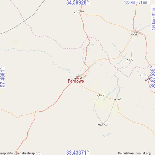
Ferdows GPS coordinates[2]
34° 1' 6.6" North, 58° 10' 19.992" East
| Map corner | latitude | longitude |
|---|---|---|
| Upper-left | 34.59928°, | 57.4691° |
| Center: | 34.0185°, | 58.17222° |
| Lower-right: | 33.43371°, | 58.87535° |
| Map W x H: | 129.6×129.6 km | = 80.5×80.5mi |
| max Lat: | 39.6482° ⇑53.3% North |
| Ferdows: | 34.0185° |
| min Lat: | ⇓46.7% South 25.2919° |
| min Long | Ferdows | max Long |
| 44.38416° | 58.17222° | 61.9965° |
| W 88.7%⇐ | ⇒11.3% E |
Elevation
Elevation of Ferdows is 1279 m = 4196 ft, and this is 230 m = 755 ft above average elevation for this country.
| Max E: |
2564 m = 8412 ft | 43.5% |
| Ferdows | 1279 m 4196 ft | |
| Avg. | 1049 m = 3442 ft | |
Min E: |
-24 m = -79 ft | 56.5% |
See also: Iran elevation on elevation.city.
Geographical zone
Ferdows is located in North temperate zone (between Tropic of Cancer and the Arctic Circle). Distance of this Northern Tropic circle is 1176.6 km =731.1 mi to South.| Distance of | km | miles | from Ferdows |
|---|---|---|---|
| North Pole | 6224.6 | 3867.8 | to North |
| Arctic Circle | 3618.7 | 2248.6 | to North |
| Tropic Cancer | 1176.6 | 731.1 | to South |
| Equator | 3782.5 | 2350.3 | to South |


Nearby cities:
15 places around Ferdows: (largest is in red/bold)
• Asadīyeh
186.8 km =116.1 mi,  129°
129°
• Bajestān
55.4 km =34.4 mi,  1°
1°
• Bardaskan
139.5 km =86.7 mi,  352°
352°
• Boshrūyeh
70.6 km =43.9 mi,  256°
256°
• Bīrjand
160.9 km =100 mi,  142°
142°
• Feyẕābād
124.5 km =77.4 mi,  26°
26°
• Gonābād
60 km =37.3 mi,  51°
51°
• Khalīlābād
137.8 km =85.6 mi, 4°
• Kāshmar
138.3 km =85.9 mi,  11°
11°
• Qā’en
98.9 km =61.5 mi,  109°
109°
• Roshtkhvār
170.4 km =105.9 mi, 51°
• Sarāyān
36.7 km =22.8 mi,  118°
118°
• Tabas
124.5 km =77.4 mi,  247°
247°
• Torbat-e Ḩeydarīyeh
169.3 km =105.2 mi, 34°
• Ḩājjīābād
174.4 km =108.4 mi, 105°
Sources, notices
• [Note1] Compared only with cities in Iran existing in our database
• [Src1] Map data: © OpenStreetMap contributors (CC-BY-SA)
• [Src2] Other city data from geonames.org with taken over terms of usage.
• [Src3] Geographical zone / Annual Mean Temperature by Robert A. Rohde @ Wikipedia
