Dārān geodata
Dārān (Isfahan) is a seat of a second-order administrative division; located in Iran in Asia/Tehran (GMT+3.5) time zone. In our database, there are 232 cities with bigger population. Compared to other cities in Iran, 61% of cities are located further ↑North; 58.5% of cities are located further →East and 98.9% of cities have lower elevation than Dārān. Note1


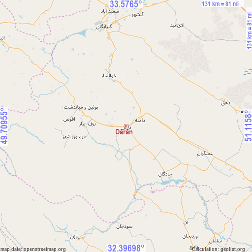
Dārān GPS coordinates[2]
32° 59' 19.356" North, 50° 24' 45.612" East
| Map corner | latitude | longitude |
|---|---|---|
| Upper-left | 33.5765°, | 49.70955° |
| Center: | 32.98871°, | 50.41267° |
| Lower-right: | 32.39698°, | 51.1158° |
| Map W x H: | 131.2×131.2 km | = 81.5×81.5mi |
| max Lat: | 39.6482° ⇑61% North |
| Dārān: | 32.98871° |
| min Lat: | ⇓39% South 25.2919° |
| min Long | Dārān | max Long |
| 44.38416° | 50.41267° | 61.9965° |
| W 41.5%⇐ | ⇒58.5% E |
Elevation
Elevation of Dārān is 2315 m = 7595 ft, and this is 1266 m = 4154 ft above average elevation for this country.
| Max E: |
2564 m = 8412 ft | 1.1% |
| Dārān | 2315 m 7595 ft | |
| Avg. | 1049 m = 3442 ft | |
Min E: |
-24 m = -79 ft | 98.9% |
See also: Iran elevation on elevation.city.
Geographical zone
Dārān is located in North temperate zone (between Tropic of Cancer and the Arctic Circle). Distance of this Northern Tropic circle is 1062.1 km =660 mi to South.| Distance of | km | miles | from Dārān |
|---|---|---|---|
| North Pole | 6339.1 | 3938.9 | to North |
| Arctic Circle | 3733.2 | 2319.7 | to North |
| Tropic Cancer | 1062.1 | 660 | to South |
| Equator | 3668 | 2279.2 | to South |


Nearby cities:
15 places around Dārān: (largest is in red/bold)
• Alīgūdarz
81.4 km =50.6 mi,  304°
304°
• Aznā
103 km =64 mi, 300°
• Chelgard
64 km =39.8 mi,  205°
205°
• Chādegān
31.7 km =19.7 mi,  140°
140°
• Fareydūnshahr
27.7 km =17.2 mi,  258°
258°
• Farrokh Shahr
95.8 km =59.5 mi,  146°
146°
• Fārsān
82.5 km =51.3 mi,  170°
170°
• Golpāyegān
53 km =32.9 mi,  347°
347°
• Khomeyn
78.6 km =48.8 mi,  336°
336°
• Khvānsār
27.3 km =17 mi, 340°
• Maḩallāt
102.6 km =63.8 mi,  2°
2°
• Najafābād
97.5 km =60.6 mi,  113°
113°
• Shahr-e Kord
84.6 km =52.6 mi, 150°
• Shāhīn Shahr
107.4 km =66.7 mi,  97°
97°
• Tīrān
76.2 km =47.3 mi, 114°
Sources, notices
• [Note1] Compared only with cities in Iran existing in our database
• [Src1] Map data: © OpenStreetMap contributors (CC-BY-SA)
• [Src2] Other city data from geonames.org with taken over terms of usage.
• [Src3] Geographical zone / Annual Mean Temperature by Robert A. Rohde @ Wikipedia
