Khomeyn geodata
Khomeyn (Markazi) is a seat of a second-order administrative division; located in Iran in Asia/Tehran (GMT+3.5) time zone. With population of 77,425 people, there are 87 cities with bigger population in this country. Compared to other cities in Iran, 56.2% of cities are located further ↑North; 61.7% of cities are located further →East and 85.3% of cities have lower elevation than Khomeyn. Note1


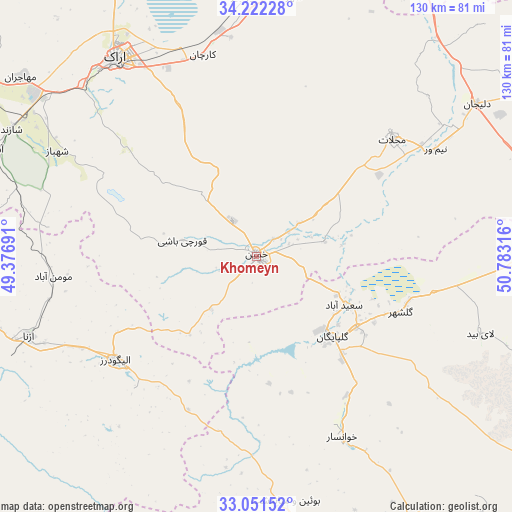
Khomeyn GPS coordinates[2]
33° 38' 20.004" North, 50° 4' 48.108" East
| Map corner | latitude | longitude |
|---|---|---|
| Upper-left | 34.22228°, | 49.37691° |
| Center: | 33.63889°, | 50.08003° |
| Lower-right: | 33.05152°, | 50.78316° |
| Map W x H: | 130.2×130.2 km | = 80.9×80.9mi |
| max Lat: | 39.6482° ⇑56.2% North |
| Khomeyn: | 33.63889° |
| min Lat: | ⇓43.8% South 25.2919° |
| min Long | Khomeyn | max Long |
| 44.38416° | 50.08003° | 61.9965° |
| W 38.3%⇐ | ⇒61.7% E |
Elevation
Elevation of Khomeyn is 1788 m = 5866 ft, and this is 739 m = 2425 ft above average elevation for this country.
| Max E: |
2564 m = 8412 ft | 14.7% |
| Khomeyn | 1788 m 5866 ft | |
| Avg. | 1049 m = 3442 ft | |
Min E: |
-24 m = -79 ft | 85.3% |
See also: Khomeyn elevation on elevation.city.
Geographical zone
Khomeyn is located in North temperate zone (between Tropic of Cancer and the Arctic Circle). Distance of this Northern Tropic circle is 1134.4 km =704.9 mi to South.| Distance of | km | miles | from Khomeyn |
|---|---|---|---|
| North Pole | 6266.8 | 3894 | to North |
| Arctic Circle | 3660.9 | 2274.8 | to North |
| Tropic Cancer | 1134.4 | 704.9 | to South |
| Equator | 3740.3 | 2324.1 | to South |


Nearby cities:
15 places around Khomeyn: (largest is in red/bold)
• Alīgūdarz
44.5 km =27.7 mi,  234°
234°
• Arāk
61.8 km =38.4 mi,  325°
325°
• Aznā
61.2 km =38 mi,  250°
250°
• Aznā
106.5 km =66.2 mi,  268°
268°
• Chādegān
109.4 km =68 mi,  152°
152°
• Delījān
68.1 km =42.3 mi,  54°
54°
• Dorūd
95.8 km =59.5 mi,  260°
260°
• Dārān
78.6 km =48.8 mi,  156°
156°
• Fareydūnshahr
77.7 km =48.3 mi,  177°
177°
• Farmahīn
102.8 km =63.9 mi,  339°
339°
• Golpāyegān
28.2 km =17.5 mi,  136°
136°
• Khvānsār
51.4 km =31.9 mi, 154°
• Maḩallāt
45.9 km =28.5 mi, 48°
• Shāzand
70.2 km =43.6 mi,  297°
297°
• Āshtīān
98.5 km =61.2 mi,  356°
356°
Sources, notices
• [Note1] Compared only with cities in Iran existing in our database
• [Src1] Map data: © OpenStreetMap contributors (CC-BY-SA)
• [Src2] Other city data from geonames.org with taken over terms of usage.
• [Src3] Geographical zone / Annual Mean Temperature by Robert A. Rohde @ Wikipedia
