Aznā geodata
Aznā (Lorestān) is a seat of a second-order administrative division; located in Iran in Asia/Tehran (GMT+3.5) time zone. In our database, there are 232 cities with bigger population. Compared to other cities in Iran, 58.7% of cities are located further ↑North; 66.4% of cities are located further →East and 90.5% of cities have lower elevation than Aznā. Note1


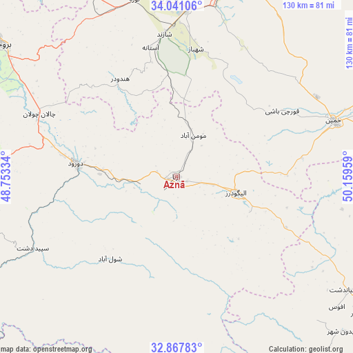
Aznā GPS coordinates[2]
33° 27' 23.148" North, 49° 27' 23.256" East
| Map corner | latitude | longitude |
|---|---|---|
| Upper-left | 34.04106°, | 48.75334° |
| Center: | 33.45643°, | 49.45646° |
| Lower-right: | 32.86783°, | 50.15959° |
| Map W x H: | 130.5×130.5 km | = 81.1×81.1mi |
| max Lat: | 39.6482° ⇑58.7% North |
| Aznā: | 33.45643° |
| min Lat: | ⇓41.3% South 25.2919° |
| min Long | Aznā | max Long |
| 44.38416° | 49.45646° | 61.9965° |
| W 33.6%⇐ | ⇒66.4% E |
Elevation
Elevation of Aznā is 1862 m = 6109 ft, and this is 813 m = 2667 ft above average elevation for this country.
| Max E: |
2564 m = 8412 ft | 9.5% |
| Aznā | 1862 m 6109 ft | |
| Avg. | 1049 m = 3442 ft | |
Min E: |
-24 m = -79 ft | 90.5% |
See also: Iran elevation on elevation.city.
Geographical zone
Aznā is located in North temperate zone (between Tropic of Cancer and the Arctic Circle). Distance of this Northern Tropic circle is 1114.1 km =692.3 mi to South.| Distance of | km | miles | from Aznā |
|---|---|---|---|
| North Pole | 6287.1 | 3906.6 | to North |
| Arctic Circle | 3681.2 | 2287.4 | to North |
| Tropic Cancer | 1114.1 | 692.3 | to South |
| Equator | 3720 | 2311.5 | to South |


Nearby cities:
15 places around Aznā: (largest is in red/bold)
• Alīgūdarz
22.6 km =14 mi,  104°
104°
• Anūch
109.1 km =67.8 mi,  311°
311°
• Arāk
74.4 km =46.2 mi,  17°
17°
• Aznā
51.6 km =32.1 mi,  289°
289°
• Borūjerd
81.6 km =50.7 mi, 306°
• Dorūd
36.8 km =22.9 mi,  276°
276°
• Dārān
103 km =64 mi,  120°
120°
• Fareydūnshahr
84.3 km =52.4 mi,  132°
132°
• Golpāyegān
77.2 km =48 mi,  90°
90°
• Khomeyn
61.2 km =38 mi,  70°
70°
• Khondāb
107.1 km =66.5 mi,  346°
346°
• Khorramabad
102.1 km =63.4 mi,  271°
271°
• Khvānsār
84 km =52.2 mi,  108°
108°
• Maḩallāt
105.2 km =65.4 mi,  61°
61°
• Shāzand
53 km =32.9 mi, 354°
Sources, notices
• [Note1] Compared only with cities in Iran existing in our database
• [Src1] Map data: © OpenStreetMap contributors (CC-BY-SA)
• [Src2] Other city data from geonames.org with taken over terms of usage.
• [Src3] Geographical zone / Annual Mean Temperature by Robert A. Rohde @ Wikipedia
