Khvānsār geodata
Khvānsār (Isfahan) is a seat of a second-order administrative division; located in Iran in Asia/Tehran (GMT+3.5) time zone. With population of 21,146 people, there are 190 cities with bigger population in this country. Compared to other cities in Iran, 59.9% of cities are located further ↑North; 59.4% of cities are located further →East and 97.5% of cities have lower elevation than Khvānsār. Note1


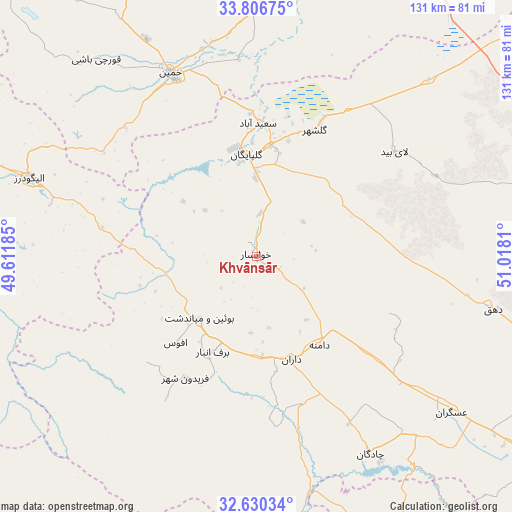
Khvānsār GPS coordinates[2]
33° 13' 13.872" North, 50° 18' 53.892" East
| Map corner | latitude | longitude |
|---|---|---|
| Upper-left | 33.80675°, | 49.61185° |
| Center: | 33.22052°, | 50.31497° |
| Lower-right: | 32.63034°, | 51.0181° |
| Map W x H: | 130.8×130.8 km | = 81.3×81.3mi |
| max Lat: | 39.6482° ⇑59.9% North |
| Khvānsār: | 33.22052° |
| min Lat: | ⇓40.1% South 25.2919° |
| min Long | Khvānsār | max Long |
| 44.38416° | 50.31497° | 61.9965° |
| W 40.6%⇐ | ⇒59.4% E |
Elevation
Elevation of Khvānsār is 2230 m = 7316 ft, and this is 1181 m = 3875 ft above average elevation for this country.
| Max E: |
2564 m = 8412 ft | 2.5% |
| Khvānsār | 2230 m 7316 ft | |
| Avg. | 1049 m = 3442 ft | |
Min E: |
-24 m = -79 ft | 97.5% |
See also: Iran elevation on elevation.city.
Geographical zone
Khvānsār is located in North temperate zone (between Tropic of Cancer and the Arctic Circle). Distance of this Northern Tropic circle is 1087.9 km =676 mi to South.| Distance of | km | miles | from Khvānsār |
|---|---|---|---|
| North Pole | 6313.3 | 3922.9 | to North |
| Arctic Circle | 3707.4 | 2303.7 | to North |
| Tropic Cancer | 1087.9 | 676 | to South |
| Equator | 3693.8 | 2295.2 | to South |


Nearby cities:
15 places around Khvānsār: (largest is in red/bold)
• Alīgūdarz
61.4 km =38.2 mi,  289°
289°
• Arāk
112.7 km =70 mi,  329°
329°
• Aznā
84 km =52.2 mi, 288°
• Chelgard
85.7 km =53.3 mi,  192°
192°
• Chādegān
58.2 km =36.2 mi,  149°
149°
• Delījān
92.2 km =57.3 mi,  21°
21°
• Dārān
27.3 km =17 mi,  160°
160°
• Fareydūnshahr
36 km =22.4 mi,  210°
210°
• Fārsān
109.6 km =68.1 mi,  167°
167°
• Golpāyegān
26 km =16.2 mi,  354°
354°
• Khomeyn
51.4 km =31.9 mi, 334°
• Maḩallāt
77.8 km =48.3 mi,  9°
9°
• Shahr-e Kord
111.6 km =69.3 mi, 152°
• Shāzand
115.5 km =71.8 mi,  313°
313°
• Tīrān
97.2 km =60.4 mi,  126°
126°
Sources, notices
• [Note1] Compared only with cities in Iran existing in our database
• [Src1] Map data: © OpenStreetMap contributors (CC-BY-SA)
• [Src2] Other city data from geonames.org with taken over terms of usage.
• [Src3] Geographical zone / Annual Mean Temperature by Robert A. Rohde @ Wikipedia
