Aznā geodata
Aznā (Lorestān) is a populated place; located in Iran in Asia/Tehran (GMT+3.5) time zone. With population of 47,482 people, there are 137 cities with bigger population in this country. Compared to other cities in Iran, 56.7% of cities are located further ↑North; 72.3% of cities are located further →East and 69.4% of cities have lower elevation than Aznā. Note1


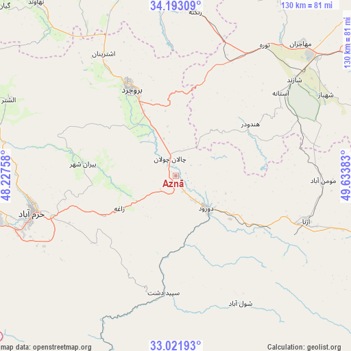
Aznā GPS coordinates[2]
33° 36' 34.2" North, 48° 55' 50.52" East
| Map corner | latitude | longitude |
|---|---|---|
| Upper-left | 34.19309°, | 48.22758° |
| Center: | 33.6095°, | 48.9307° |
| Lower-right: | 33.02193°, | 49.63383° |
| Map W x H: | 130.2×130.2 km | = 80.9×80.9mi |
| max Lat: | 39.6482° ⇑56.7% North |
| Aznā: | 33.6095° |
| min Lat: | ⇓43.3% South 25.2919° |
| min Long | Aznā | max Long |
| 44.38416° | 48.9307° | 61.9965° |
| W 27.7%⇐ | ⇒72.3% E |
Elevation
Elevation of Aznā is 1494 m = 4902 ft, and this is 445 m = 1460 ft above average elevation for this country.
| Max E: |
2564 m = 8412 ft | 30.6% |
| Aznā | 1494 m 4902 ft | |
| Avg. | 1049 m = 3442 ft | |
Min E: |
-24 m = -79 ft | 69.4% |
See also: Aznā elevation on elevation.city.
Geographical zone
Aznā is located in North temperate zone (between Tropic of Cancer and the Arctic Circle). Distance of this Northern Tropic circle is 1131.1 km =702.8 mi to South.| Distance of | km | miles | from Aznā |
|---|---|---|---|
| North Pole | 6270 | 3896 | to North |
| Arctic Circle | 3664.1 | 2276.8 | to North |
| Tropic Cancer | 1131.1 | 702.8 | to South |
| Equator | 3737 | 2322.1 | to South |


Nearby cities:
15 places around Aznā: (largest is in red/bold)
• Aleshtar
68 km =42.3 mi,  294°
294°
• Alīgūdarz
74.2 km =46.1 mi,  107°
107°
• Anūch
64.5 km =40.1 mi,  329°
329°
• Arāk
89.1 km =55.4 mi,  52°
52°
• Aznā
51.6 km =32.1 mi, 109°
• Borūjerd
36 km =22.4 mi, 332°
• Dorūd
17.8 km =11.1 mi,  137°
137°
• Famast
64.4 km =40 mi,  317°
317°
• Khorramabad
55 km =34.2 mi,  255°
255°
• Malāyer
77.6 km =48.2 mi,  352°
352°
• Nahāvand
82.5 km =51.3 mi, 321°
• Sarāb-e Dūreh
84.3 km =52.4 mi,  266°
266°
• Shāzand
56.7 km =35.2 mi, 50°
• Vasīān
82.7 km =51.4 mi, 260°
• pamas
64.4 km =40 mi, 317°
Sources, notices
• [Note1] Compared only with cities in Iran existing in our database
• [Src1] Map data: © OpenStreetMap contributors (CC-BY-SA)
• [Src2] Other city data from geonames.org with taken over terms of usage.
• [Src3] Geographical zone / Annual Mean Temperature by Robert A. Rohde @ Wikipedia
