Shāzand geodata
Shāzand (Markazi) is a seat of a second-order administrative division; located in Iran in Asia/Tehran (GMT+3.5) time zone. In our database, there are 232 cities with bigger population. Compared to other cities in Iran, 54% of cities are located further ↑North; 67.6% of cities are located further →East and 91.2% of cities have lower elevation than Shāzand. Note1


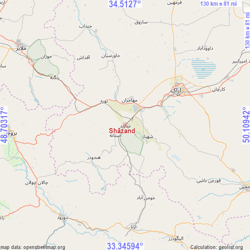
Shāzand GPS coordinates[2]
33° 55' 52.752" North, 49° 24' 22.644" East
| Map corner | latitude | longitude |
|---|---|---|
| Upper-left | 34.5127°, | 48.70317° |
| Center: | 33.93132°, | 49.40629° |
| Lower-right: | 33.34594°, | 50.10942° |
| Map W x H: | 129.7×129.7 km | = 80.6×80.6mi |
| max Lat: | 39.6482° ⇑54% North |
| Shāzand: | 33.93132° |
| min Lat: | ⇓46% South 25.2919° |
| min Long | Shāzand | max Long |
| 44.38416° | 49.40629° | 61.9965° |
| W 32.4%⇐ | ⇒67.6% E |
Elevation
Elevation of Shāzand is 1906 m = 6253 ft, and this is 857 m = 2812 ft above average elevation for this country.
| Max E: |
2564 m = 8412 ft | 8.8% |
| Shāzand | 1906 m 6253 ft | |
| Avg. | 1049 m = 3442 ft | |
Min E: |
-24 m = -79 ft | 91.2% |
See also: Iran elevation on elevation.city.
Geographical zone
Shāzand is located in North temperate zone (between Tropic of Cancer and the Arctic Circle). Distance of this Northern Tropic circle is 1166.9 km =725.1 mi to South.| Distance of | km | miles | from Shāzand |
|---|---|---|---|
| North Pole | 6234.3 | 3873.8 | to North |
| Arctic Circle | 3628.4 | 2254.6 | to North |
| Tropic Cancer | 1166.9 | 725.1 | to South |
| Equator | 3772.8 | 2344.3 | to South |


Nearby cities:
15 places around Shāzand: (largest is in red/bold)
• Alīgūdarz
64.3 km =40 mi,  155°
155°
• Anūch
79.2 km =49.2 mi,  284°
284°
• Arāk
32.5 km =20.2 mi,  55°
55°
• Aznā
53 km =32.9 mi,  174°
174°
• Aznā
56.7 km =35.2 mi,  230°
230°
• Borūjerd
60.5 km =37.6 mi,  266°
266°
• Dorūd
58.3 km =36.2 mi,  213°
213°
• Famast
87.8 km =54.6 mi, 277°
• Farmahīn
68.6 km =42.6 mi,  21°
21°
• Khomeyn
70.2 km =43.6 mi,  117°
117°
• Khondāb
55.2 km =34.3 mi,  338°
338°
• Komījān
88.2 km =54.8 mi,  355°
355°
• Malāyer
67.8 km =42.1 mi,  307°
307°
• pamas
87.9 km =54.6 mi, 277°
• Āshtīān
85.8 km =53.3 mi,  39°
39°
Sources, notices
• [Note1] Compared only with cities in Iran existing in our database
• [Src1] Map data: © OpenStreetMap contributors (CC-BY-SA)
• [Src2] Other city data from geonames.org with taken over terms of usage.
• [Src3] Geographical zone / Annual Mean Temperature by Robert A. Rohde @ Wikipedia
