Malāyer geodata
Malāyer (Hamadān) is a seat of a second-order administrative division; located in Iran in Asia/Tehran (GMT+3.5) time zone. With population of 176,573 people, there are 43 cities with bigger population in this country. Compared to other cities in Iran, 50.6% of cities are located further ↑North; 73.5% of cities are located further →East and 84.1% of cities have lower elevation than Malāyer. Note1


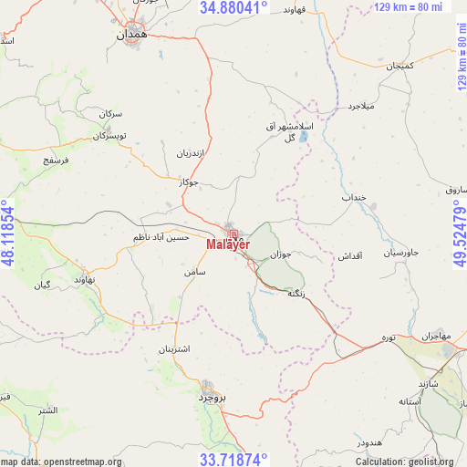
Malāyer GPS coordinates[2]
34° 18' 5.688" North, 48° 49' 17.976" East
| Map corner | latitude | longitude |
|---|---|---|
| Upper-left | 34.88041°, | 48.11854° |
| Center: | 34.30158°, | 48.82166° |
| Lower-right: | 33.71874°, | 49.52479° |
| Map W x H: | 129.2×129.2 km | = 80.3×80.3mi |
| max Lat: | 39.6482° ⇑50.6% North |
| Malāyer: | 34.30158° |
| min Lat: | ⇓49.4% South 25.2919° |
| min Long | Malāyer | max Long |
| 44.38416° | 48.82166° | 61.9965° |
| W 26.5%⇐ | ⇒73.5% E |
Elevation
Elevation of Malāyer is 1760 m = 5774 ft, and this is 711 m = 2333 ft above average elevation for this country.
| Max E: |
2564 m = 8412 ft | 15.9% |
| Malāyer | 1760 m 5774 ft | |
| Avg. | 1049 m = 3442 ft | |
Min E: |
-24 m = -79 ft | 84.1% |
See also: Malāyer elevation on elevation.city.
Geographical zone
Malāyer is located in North temperate zone (between Tropic of Cancer and the Arctic Circle). Distance of this Northern Tropic circle is 1208.1 km =750.7 mi to South.| Distance of | km | miles | from Malāyer |
|---|---|---|---|
| North Pole | 6193.1 | 3848.2 | to North |
| Arctic Circle | 3587.2 | 2229 | to North |
| Tropic Cancer | 1208.1 | 750.7 | to South |
| Equator | 3814 | 2369.9 | to South |


Nearby cities:
15 places around Malāyer: (largest is in red/bold)
• Aleshtar
70.8 km =44 mi,  226°
226°
• Anūch
31.3 km =19.4 mi, 226°
• Aznā
77.6 km =48.2 mi,  172°
172°
• Bahār
75.8 km =47.1 mi,  332°
332°
• Borūjerd
45.4 km =28.2 mi,  188°
188°
• Famast
44.1 km =27.4 mi, 228°
• Hamadān
62.1 km =38.6 mi, 333°
• Khondāb
34.8 km =21.6 mi,  73°
73°
• Komījān
65.7 km =40.8 mi,  44°
44°
• Nahāvand
42.9 km =26.7 mi,  253°
253°
• Pasragad Branch
61.9 km =38.5 mi, 328°
• Shāzand
67.8 km =42.1 mi,  127°
127°
• Tūyserkān
44.4 km =27.6 mi,  308°
308°
• pamas
44.2 km =27.5 mi, 228°
• Āzādshahr
59 km =36.7 mi,  337°
337°
Sources, notices
• [Note1] Compared only with cities in Iran existing in our database
• [Src1] Map data: © OpenStreetMap contributors (CC-BY-SA)
• [Src2] Other city data from geonames.org with taken over terms of usage.
• [Src3] Geographical zone / Annual Mean Temperature by Robert A. Rohde @ Wikipedia
