Estahbān geodata
Estahbān (Fars) is a seat of a second-order administrative division; located in Iran in Asia/Tehran (GMT+3.5) time zone. In our database, there are 232 cities with bigger population. Compared to other cities in Iran, 87.8% of cities are located further ↑North; 71.7% of cities are located further ←West and 83.2% of cities have lower elevation than Estahbān. Note1


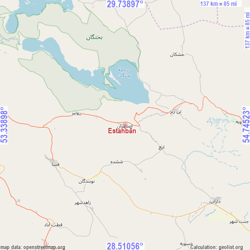
Estahbān GPS coordinates[2]
29° 7' 35.76" North, 54° 2' 31.56" East
| Map corner | latitude | longitude |
|---|---|---|
| Upper-left | 29.73897°, | 53.33898° |
| Center: | 29.1266°, | 54.0421° |
| Lower-right: | 28.51056°, | 54.74523° |
| Map W x H: | 136.6×136.6 km | = 84.9×84.9mi |
| max Lat: | 39.6482° ⇑87.8% North |
| Estahbān: | 29.1266° |
| min Lat: | ⇓12.2% South 25.2919° |
| min Long | Estahbān | max Long |
| 44.38416° | 54.0421° | 61.9965° |
| W 71.7%⇐ | ⇒28.3% E |
Elevation
Elevation of Estahbān is 1743 m = 5719 ft, and this is 694 m = 2277 ft above average elevation for this country.
| Max E: |
2564 m = 8412 ft | 16.8% |
| Estahbān | 1743 m 5719 ft | |
| Avg. | 1049 m = 3442 ft | |
Min E: |
-24 m = -79 ft | 83.2% |
See also: Iran elevation on elevation.city.
Geographical zone
Estahbān is located in North temperate zone (between Tropic of Cancer and the Arctic Circle). Distance of this Northern Tropic circle is 632.7 km =393.1 mi to South.| Distance of | km | miles | from Estahbān |
|---|---|---|---|
| North Pole | 6768.5 | 4205.7 | to North |
| Arctic Circle | 4162.6 | 2586.5 | to North |
| Tropic Cancer | 632.7 | 393.1 | to South |
| Equator | 3238.6 | 2012.4 | to South |


Nearby cities:
15 places around Estahbān: (largest is in red/bold)
• Akbarābād
123.3 km =76.6 mi,  276°
276°
• Arsanjān
112.6 km =70 mi,  320°
320°
• Dārāb
64.2 km =39.9 mi,  130°
130°
• Fasā
43.6 km =27.1 mi,  241°
241°
• Jahrom
84 km =52.2 mi,  213°
213°
• Kavār
131.6 km =81.8 mi,  273°
273°
• Kherāmeh
82 km =51 mi,  300°
300°
• Marvdasht
145.9 km =90.7 mi, 304°
• Neyrīz
28.9 km =18 mi,  73°
73°
• Pāsārgād
145.7 km =90.5 mi,  325°
325°
• Qīr
121.5 km =75.5 mi,  233°
233°
• Sarvestān
81.4 km =50.6 mi, 281°
• Sa‘ādat Shahr
137.5 km =85.4 mi, 320°
• Shahr-e Herāt
108 km =67.1 mi,  17°
17°
• Ḩājjīābād
93.3 km =58 mi,  156°
156°
Sources, notices
• [Note1] Compared only with cities in Iran existing in our database
• [Src1] Map data: © OpenStreetMap contributors (CC-BY-SA)
• [Src2] Other city data from geonames.org with taken over terms of usage.
• [Src3] Geographical zone / Annual Mean Temperature by Robert A. Rohde @ Wikipedia
