Shahr-e Herāt geodata
Shahr-e Herāt (Yazd) is a seat of a second-order administrative division; located in Iran in Asia/Tehran (GMT+3.5) time zone. In our database, there are 232 cities with bigger population. Compared to other cities in Iran, 83.2% of cities are located further ↑North; 74.4% of cities are located further ←West and 76.2% of cities have lower elevation than Shahr-e Herāt. Note1


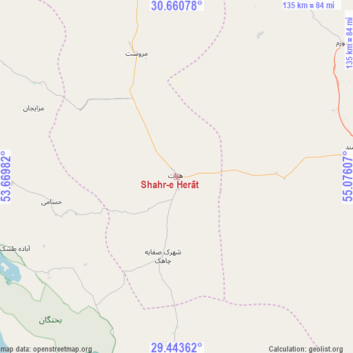
Shahr-e Herāt GPS coordinates[2]
30° 3' 14.652" North, 54° 22' 22.584" East
| Map corner | latitude | longitude |
|---|---|---|
| Upper-left | 30.66078°, | 53.66982° |
| Center: | 30.05407°, | 54.37294° |
| Lower-right: | 29.44362°, | 55.07607° |
| Map W x H: | 135.3×135.3 km | = 84.1×84.1mi |
| max Lat: | 39.6482° ⇑83.2% North |
| Shahr-e Herāt: | 30.05407° |
| min Lat: | ⇓16.8% South 25.2919° |
| min Long | Shahr-e Herāt | max Long |
| 44.38416° | 54.37294° | 61.9965° |
| W 74.4%⇐ | ⇒25.6% E |
Elevation
Elevation of Shahr-e Herāt is 1595 m = 5233 ft, and this is 546 m = 1791 ft above average elevation for this country.
| Max E: |
2564 m = 8412 ft | 23.8% |
| Shahr-e Herāt | 1595 m 5233 ft | |
| Avg. | 1049 m = 3442 ft | |
Min E: |
-24 m = -79 ft | 76.2% |
See also: Iran elevation on elevation.city.
Geographical zone
Shahr-e Herāt is located in North temperate zone (between Tropic of Cancer and the Arctic Circle). Distance of this Northern Tropic circle is 735.8 km =457.2 mi to South.| Distance of | km | miles | from Shahr-e Herāt |
|---|---|---|---|
| North Pole | 6665.4 | 4141.7 | to North |
| Arctic Circle | 4059.5 | 2522.5 | to North |
| Tropic Cancer | 735.8 | 457.2 | to South |
| Equator | 3341.7 | 2076.4 | to South |


Nearby cities:
15 places around Shahr-e Herāt: (largest is in red/bold)
• Anār
125.1 km =77.7 mi,  43°
43°
• Arsanjān
103.7 km =64.4 mi,  261°
261°
• Dārāb
145.7 km =90.5 mi,  173°
173°
• Estahbān
108 km =67.1 mi,  197°
197°
• Fasā
142.5 km =88.5 mi,  209°
209°
• Kherāmeh
119.6 km =74.3 mi,  238°
238°
• Marvdasht
152.6 km =94.8 mi, 262°
• Neyrīz
95.2 km =59.2 mi,  182°
182°
• Pāsārgād
115.9 km =72 mi,  278°
278°
• Sarvestān
141.2 km =87.7 mi,  232°
232°
• Sa‘ādat Shahr
119.2 km =74.1 mi,  271°
271°
• Shahr-e Bābak
72.1 km =44.8 mi,  84°
84°
• Sirjan
142.9 km =88.8 mi,  117°
117°
• Sūrīān
82.4 km =51.2 mi,  302°
302°
• Şafāshahr
129 km =80.2 mi, 298°
Sources, notices
• [Note1] Compared only with cities in Iran existing in our database
• [Src1] Map data: © OpenStreetMap contributors (CC-BY-SA)
• [Src2] Other city data from geonames.org with taken over terms of usage.
• [Src3] Geographical zone / Annual Mean Temperature by Robert A. Rohde @ Wikipedia
