Razan geodata
Razan (Hamadān) is a seat of a second-order administrative division; located in Iran in Asia/Tehran (GMT+3.5) time zone. In our database, there are 232 cities with bigger population. Compared to other cities in Iran, 61.5% of cities are located further ↓South; 71.4% of cities are located further →East and 89.3% of cities have lower elevation than Razan. Note1


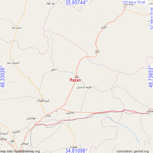
Razan GPS coordinates[2]
35° 23' 10.5" North, 49° 2' 0.24" East
| Map corner | latitude | longitude |
|---|---|---|
| Upper-left | 35.95744°, | 48.33028° |
| Center: | 35.38625°, | 49.0334° |
| Lower-right: | 34.81098°, | 49.73653° |
| Map W x H: | 127.5×127.5 km | = 79.2×79.2mi |
| max Lat: | 39.6482° ⇑38.5% North |
| Razan: | 35.38625° |
| min Lat: | ⇓61.5% South 25.2919° |
| min Long | Razan | max Long |
| 44.38416° | 49.0334° | 61.9965° |
| W 28.6%⇐ | ⇒71.4% E |
Elevation
Elevation of Razan is 1845 m = 6053 ft, and this is 796 m = 2612 ft above average elevation for this country.
| Max E: |
2564 m = 8412 ft | 10.7% |
| Razan | 1845 m 6053 ft | |
| Avg. | 1049 m = 3442 ft | |
Min E: |
-24 m = -79 ft | 89.3% |
See also: Iran elevation on elevation.city.
Geographical zone
Razan is located in North temperate zone (between Tropic of Cancer and the Arctic Circle). Distance of this Northern Tropic circle is 1328.7 km =825.6 mi to South.| Distance of | km | miles | from Razan |
|---|---|---|---|
| North Pole | 6072.5 | 3773.3 | to North |
| Arctic Circle | 3466.6 | 2154 | to North |
| Tropic Cancer | 1328.7 | 825.6 | to South |
| Equator | 3934.6 | 2444.8 | to South |


Nearby cities:
15 places around Razan: (largest is in red/bold)
• Abhar
86.2 km =53.6 mi,  11°
11°
• Alvand
104.4 km =64.9 mi, 6°
• Asadābād
106.8 km =66.4 mi,  231°
231°
• Bahār
75.7 km =47 mi, 225°
• Bū’īn Zahrā
101.9 km =63.3 mi,  65°
65°
• Fāmenīn
30.5 km =19 mi,  190°
190°
• Hamadān
80.6 km =50.1 mi,  215°
215°
• Kabūdarāhang
34.3 km =21.3 mi,  235°
235°
• Khorramdarreh
92.5 km =57.5 mi, 9°
• Komījān
78.6 km =48.8 mi,  160°
160°
• Pasragad Branch
84.8 km =52.7 mi, 217°
• Qohūrd-e ‘Olyā
87.2 km =54.2 mi,  273°
273°
• Tākestān
96.8 km =60.1 mi,  38°
38°
• Tūyserkān
107.3 km =66.7 mi,  210°
210°
• Āzādshahr
78.5 km =48.8 mi, 212°
Sources, notices
• [Note1] Compared only with cities in Iran existing in our database
• [Src1] Map data: © OpenStreetMap contributors (CC-BY-SA)
• [Src2] Other city data from geonames.org with taken over terms of usage.
• [Src3] Geographical zone / Annual Mean Temperature by Robert A. Rohde @ Wikipedia
