Ābādeh geodata
Ābādeh (Fars) is a seat of a second-order administrative division; located in Iran in Asia/Tehran (GMT+3.5) time zone. With population of 56,988 people, there are 113 cities with bigger population in this country. Compared to other cities in Iran, 75.1% of cities are located further ↑North; 62.6% of cities are located further ←West and 93.7% of cities have lower elevation than Ābādeh. Note1


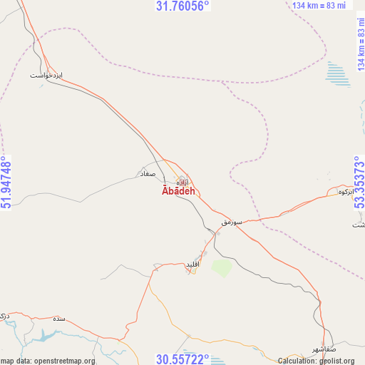
Ābādeh GPS coordinates[2]
31° 9' 38.88" North, 52° 39' 2.16" East
| Map corner | latitude | longitude |
|---|---|---|
| Upper-left | 31.76056°, | 51.94748° |
| Center: | 31.1608°, | 52.6506° |
| Lower-right: | 30.55722°, | 53.35373° |
| Map W x H: | 133.8×133.8 km | = 83.1×83.1mi |
| max Lat: | 39.6482° ⇑75.1% North |
| Ābādeh: | 31.1608° |
| min Lat: | ⇓24.9% South 25.2919° |
| min Long | Ābādeh | max Long |
| 44.38416° | 52.6506° | 61.9965° |
| W 62.6%⇐ | ⇒37.4% E |
Elevation
Elevation of Ābādeh is 2006 m = 6581 ft, and this is 957 m = 3140 ft above average elevation for this country.
| Max E: |
2564 m = 8412 ft | 6.3% |
| Ābādeh | 2006 m 6581 ft | |
| Avg. | 1049 m = 3442 ft | |
Min E: |
-24 m = -79 ft | 93.7% |
See also: Ābādeh elevation on elevation.city.
Geographical zone
Ābādeh is located in North temperate zone (between Tropic of Cancer and the Arctic Circle). Distance of this Northern Tropic circle is 858.8 km =533.6 mi to South.| Distance of | km | miles | from Ābādeh |
|---|---|---|---|
| North Pole | 6542.3 | 4065.2 | to North |
| Arctic Circle | 3936.4 | 2446 | to North |
| Tropic Cancer | 858.8 | 533.6 | to South |
| Equator | 3464.8 | 2152.9 | to South |


Nearby cities:
15 places around Ābādeh: (largest is in red/bold)
• Abarkūh
60.2 km =37.4 mi,  93°
93°
• Arsanjān
152.4 km =94.7 mi,  155°
155°
• Dehāqān
128.6 km =79.9 mi,  312°
312°
• Eqlīd
29.5 km =18.3 mi,  171°
171°
• Marvdasht
143.8 km =89.4 mi, 174°
• Maşīrī
148.3 km =92.1 mi,  226°
226°
• Pāsārgād
118 km =73.3 mi,  154°
154°
• Sa‘ādat Shahr
128.9 km =80.1 mi, 158°
• Semīrom
106.8 km =66.4 mi,  285°
285°
• Sepīdān
118.6 km =73.7 mi,  212°
212°
• Shahreẕā
120 km =74.6 mi,  321°
321°
• Sīsakht
118.5 km =73.6 mi,  253°
253°
• Sūrīān
123.6 km =76.8 mi,  129°
129°
• Yasuj
115.2 km =71.6 mi,  241°
241°
• Şafāshahr
80.1 km =49.8 mi,  139°
139°
Sources, notices
• [Note1] Compared only with cities in Iran existing in our database
• [Src1] Map data: © OpenStreetMap contributors (CC-BY-SA)
• [Src2] Other city data from geonames.org with taken over terms of usage.
• [Src3] Geographical zone / Annual Mean Temperature by Robert A. Rohde @ Wikipedia
