Kalāt-e Nāderī geodata
Kalāt-e Nāderī (Razavi Khorasan) is a seat of a second-order administrative division; located in Iran in Asia/Tehran (GMT+3.5) time zone. In our database, there are 232 cities with bigger population. Compared to other cities in Iran, 83.2% of cities are located further ↓South; 94.8% of cities are located further ←West and 63.9% of cities have higher elevation than Kalāt-e Nāderī. Note1


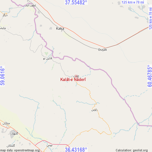
Kalāt-e Nāderī GPS coordinates[2]
36° 59' 43.152" North, 59° 45' 52.992" East
| Map corner | latitude | longitude |
|---|---|---|
| Upper-left | 37.55482°, | 59.0616° |
| Center: | 36.99532°, | 59.76472° |
| Lower-right: | 36.43168°, | 60.46785° |
| Map W x H: | 124.9×124.9 km | = 77.6×77.6mi |
| max Lat: | 39.6482° ⇑16.8% North |
| Kalāt-e Nāderī: | 36.99532° |
| min Lat: | ⇓83.2% South 25.2919° |
| min Long | Kalāt-e Nāder | max Long |
| 44.38416° | 59.76472° | 61.9965° |
| W 94.8%⇐ | ⇒5.2% E |
Elevation
Elevation of Kalāt-e Nāderī is 881 m = 2890 ft, and this is 168 m = 551 ft below average elevation for this country.
| Max E: |
2564 m = 8412 ft | 63.9% |
| Avg. | 1049 m = 3442 ft | |
| Kalāt-e Nāderī | 881 m = 2890 ft | |
Min E: |
-24 m = -79 ft | 36.1% |
See also: Iran elevation on elevation.city.
Geographical zone
Kalāt-e Nāderī is located in North temperate zone (between Tropic of Cancer and the Arctic Circle). Distance of this Northern Tropic circle is 1507.6 km =936.8 mi to South.| Distance of | km | miles | from Kalāt-e Nāderī |
|---|---|---|---|
| North Pole | 5893.6 | 3662.1 | to North |
| Arctic Circle | 3287.7 | 2042.9 | to North |
| Tropic Cancer | 1507.6 | 936.8 | to South |
| Equator | 4113.5 | 2556 | to South |


Nearby cities:
15 places around Kalāt-e Nāderī: (largest is in red/bold)
• Bozghān
131.4 km =81.6 mi,  233°
233°
• Chenārān
69.2 km =43 mi,  235°
235°
• Dargaz
76.6 km =47.6 mi,  310°
310°
• Dowlatābād
191.7 km =119.1 mi,  186°
186°
• Esfarāyen
200.3 km =124.5 mi,  272°
272°
• Farīmān
143.5 km =89.2 mi,  176°
176°
• Fārūj
139.5 km =86.7 mi,  280°
280°
• Mashhad
77.6 km =48.2 mi, 193°
• Neyshābūr
122.6 km =76.2 mi,  224°
224°
• Qūchān
112.1 km =69.7 mi, 276°
• Sarakhs
133.8 km =83.1 mi,  111°
111°
• Shīrvān
168.6 km =104.8 mi,  285°
285°
• Solţānābād
167.3 km =104 mi,  246°
246°
• Torbat-e Ḩeydarīyeh
197.6 km =122.8 mi, 194°
• Ţorqabeh
83.8 km =52.1 mi,  204°
204°
Sources, notices
• [Note1] Compared only with cities in Iran existing in our database
• [Src1] Map data: © OpenStreetMap contributors (CC-BY-SA)
• [Src2] Other city data from geonames.org with taken over terms of usage.
• [Src3] Geographical zone / Annual Mean Temperature by Robert A. Rohde @ Wikipedia
