Tokmok geodata
Tokmok (Chüy) is a seat of a second-order administrative division; located in Kyrgyzstan in Asia/Bishkek (GMT+6) time zone. With population of 63,047 people, there are 4 cities with bigger population in this country. Compared to other cities in Kyrgyzstan, 94% of cities are located further ↓South; 84.5% of cities are located further ←West and 70.2% of cities have higher elevation than Tokmok. Note1


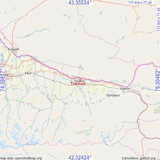
Tokmok GPS coordinates[2]
42° 50' 30.984" North, 75° 18' 5.364" East
| Map corner | latitude | longitude |
|---|---|---|
| Upper-left | 43.35534°, | 74.59837° |
| Center: | 42.84194°, | 75.30149° |
| Lower-right: | 42.32424°, | 76.00462° |
| Map W x H: | 114.6×114.6 km | = 71.2×71.2mi |
| max Lat: | 42.89106° ⇑6% North |
| Tokmok: | 42.84194° |
| min Lat: | ⇓94% South 39.55274° |
| min Long | Tokmok | max Long |
| 69.3716° | 75.30149° | 78.52702° |
| W 84.5%⇐ | ⇒15.5% E |
Elevation
Elevation of Tokmok is 824 m = 2703 ft, and this is 377.4 m = 1238 ft below average elevation for this country.
| Max E: |
2638 m = 8655 ft | 70.2% |
| Avg. | 1201.4 m = 3942 ft | |
| Tokmok | 824 m = 2703 ft | |
Min E: |
504 m = 1654 ft | 29.8% |
See also: Tokmok elevation on elevation.city.
Geographical zone
Tokmok is located in North temperate zone (between Tropic of Cancer and the Arctic Circle). Distance of this Northern Tropic circle is 2157.7 km =1340.7 mi to South.| Distance of | km | miles | from Tokmok |
|---|---|---|---|
| North Pole | 5243.5 | 3258.2 | to North |
| Arctic Circle | 2637.6 | 1638.9 | to North |
| Tropic Cancer | 2157.7 | 1340.7 | to South |
| Equator | 4763.6 | 2960 | to South |


Nearby cities:
15 places around Tokmok: (largest is in red/bold)
• Balykchy
83.9 km =52.1 mi,  120°
120°
• Belovodskoye
97.3 km =60.5 mi,  269°
269°
• Bishkek
58.1 km =36.1 mi, 273°
• Chayek
120.4 km =74.8 mi,  212°
212°
• Cholpon-Ata
147 km =91.3 mi,  98°
98°
• Chuy
2.9 km =1.8 mi, 212°
• Ivanovka
18.4 km =11.4 mi,  286°
286°
• Kaindy
132.6 km =82.4 mi, 269°
• Kant
37.1 km =23.1 mi,  278°
278°
• Kara-Balta
118.6 km =73.7 mi, 268°
• Kemin
32.4 km =20.1 mi, 101°
• Kochkor
79 km =49.1 mi,  151°
151°
• Lebedinovka
51 km =31.7 mi, 275°
• Sokuluk
81.4 km =50.6 mi, 270°
• Sosnovka
117 km =72.7 mi,  258°
258°
Sources, notices
• [Note1] Compared only with cities in Kyrgyzstan existing in our database
• [Src1] Map data: © OpenStreetMap contributors (CC-BY-SA)
• [Src2] Other city data from geonames.org with taken over terms of usage.
• [Src3] Geographical zone / Annual Mean Temperature by Robert A. Rohde @ Wikipedia
