Sosnovka geodata
Sosnovka (Chüy) is a populated place; located in Kyrgyzstan in Asia/Bishkek (GMT+6) time zone. With population of 5,885 people, there are 31 cities with bigger population in this country. Compared to other cities in Kyrgyzstan, 83.3% of cities are located further ↓South; 71.4% of cities are located further ←West and 56% of cities have lower elevation than Sosnovka. Note1


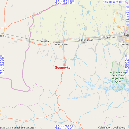
Sosnovka GPS coordinates[2]
42° 38' 13.452" North, 73° 53' 45.888" East
| Map corner | latitude | longitude |
|---|---|---|
| Upper-left | 43.15218°, | 73.19296° |
| Center: | 42.63707°, | 73.89608° |
| Lower-right: | 42.11766°, | 74.59921° |
| Map W x H: | 115×115 km | = 71.5×71.5mi |
| max Lat: | 42.89106° ⇑16.7% North |
| Sosnovka: | 42.63707° |
| min Lat: | ⇓83.3% South 39.55274° |
| min Long | Sosnovka | max Long |
| 69.3716° | 73.89608° | 78.52702° |
| W 71.4%⇐ | ⇒28.6% E |
Elevation
Elevation of Sosnovka is 1208 m = 3963 ft, and this is 6.5999999999999 m = 22 ft above average elevation for this country.
| Max E: |
2638 m = 8655 ft | 44% |
| Sosnovka | 1208 m 3963 ft | |
| Avg. | 1201.4 m = 3942 ft | |
Min E: |
504 m = 1654 ft | 56% |
See also: Kyrgyzstan elevation on elevation.city.
Geographical zone
Sosnovka is located in North temperate zone (between Tropic of Cancer and the Arctic Circle). Distance of this Northern Tropic circle is 2134.9 km =1326.6 mi to South.| Distance of | km | miles | from Sosnovka |
|---|---|---|---|
| North Pole | 5266.3 | 3272.3 | to North |
| Arctic Circle | 2660.4 | 1653.1 | to North |
| Tropic Cancer | 2134.9 | 1326.6 | to South |
| Equator | 4740.8 | 2945.8 | to South |


Nearby cities:
15 places around Sosnovka: (largest is in red/bold)
• Belovodskoye
27.5 km =17.1 mi,  39°
39°
• Bishkek
62.3 km =38.7 mi,  65°
65°
• Chayek
94 km =58.4 mi,  147°
147°
• Chuy
115 km =71.5 mi,  79°
79°
• Ivanovka
101 km =62.8 mi, 73°
• Kaindy
27.5 km =17.1 mi,  319°
319°
• Kant
82.9 km =51.5 mi, 70°
• Kara-Balta
20.1 km =12.5 mi,  348°
348°
• Lebedinovka
69.5 km =43.2 mi, 66°
• Sokuluk
41 km =25.5 mi,  53°
53°
• Talas
106.3 km =66.1 mi,  252°
252°
• Talas
136 km =84.5 mi,  264°
264°
• Tokmok
117 km =72.7 mi, 78°
• Toktogul
115.6 km =71.8 mi,  222°
222°
• Üch-Terek
112.9 km =70.2 mi,  210°
210°
Sources, notices
• [Note1] Compared only with cities in Kyrgyzstan existing in our database
• [Src1] Map data: © OpenStreetMap contributors (CC-BY-SA)
• [Src2] Other city data from geonames.org with taken over terms of usage.
• [Src3] Geographical zone / Annual Mean Temperature by Robert A. Rohde @ Wikipedia
