Cholpon-Ata geodata
Cholpon-Ata (Issyk-Kul) is a seat of a second-order administrative division; located in Kyrgyzstan in Asia/Bishkek (GMT+6) time zone. With population of 18,595 people, there are 16 cities with bigger population in this country. Compared to other cities in Kyrgyzstan, 84.5% of cities are located further ↓South; 92.9% of cities are located further ←West and 79.8% of cities have lower elevation than Cholpon-Ata. Note1


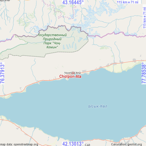
Cholpon-Ata GPS coordinates[2]
42° 38' 57.984" North, 77° 4' 56.1" East
| Map corner | latitude | longitude |
|---|---|---|
| Upper-left | 43.16445°, | 76.37913° |
| Center: | 42.64944°, | 77.08225° |
| Lower-right: | 42.13013°, | 77.78538° |
| Map W x H: | 115×115 km | = 71.5×71.5mi |
| max Lat: | 42.89106° ⇑15.5% North |
| Cholpon-Ata: | 42.64944° |
| min Lat: | ⇓84.5% South 39.55274° |
| min Long | Cholpon-Ata | max Long |
| 69.3716° | 77.08225° | 78.52702° |
| W 92.9%⇐ | ⇒7.1% E |
Elevation
Elevation of Cholpon-Ata is 1630 m = 5348 ft, and this is 428.6 m = 1406 ft above average elevation for this country.
| Max E: |
2638 m = 8655 ft | 20.2% |
| Cholpon-Ata | 1630 m 5348 ft | |
| Avg. | 1201.4 m = 3942 ft | |
Min E: |
504 m = 1654 ft | 79.8% |
See also: Kyrgyzstan elevation on elevation.city.
Geographical zone
Cholpon-Ata is located in North temperate zone (between Tropic of Cancer and the Arctic Circle). Distance of this Northern Tropic circle is 2136.3 km =1327.4 mi to South.| Distance of | km | miles | from Cholpon-Ata |
|---|---|---|---|
| North Pole | 5264.9 | 3271.5 | to North |
| Arctic Circle | 2659 | 1652.2 | to North |
| Tropic Cancer | 2136.3 | 1327.4 | to South |
| Equator | 4742.2 | 2946.7 | to South |


Nearby cities:
15 places around Cholpon-Ata: (largest is in red/bold)
• Ak-Suu
119.5 km =74.3 mi,  98°
98°
• Balykchy
76.3 km =47.4 mi,  253°
253°
• Bokombayevskoye
59.6 km =37 mi,  187°
187°
• Chuy
148.2 km =92.1 mi,  277°
277°
• Ivanovka
165.2 km =102.7 mi, 279°
• Kadzhi-Say
57.1 km =35.5 mi,  172°
172°
• Kant
184.1 km =114.4 mi, 278°
• Karakol
108.8 km =67.6 mi, 99°
• Kemin
114.6 km =71.2 mi, 277°
• Kochkor
119 km =73.9 mi, 246°
• Kyzyl-Suu
83.1 km =51.6 mi,  114°
114°
• Naryn
162.9 km =101.2 mi,  213°
213°
• Tokmok
147 km =91.3 mi, 278°
• Tossor
61 km =37.9 mi,  151°
151°
• Tyup
105.2 km =65.4 mi,  85°
85°
Sources, notices
• [Note1] Compared only with cities in Kyrgyzstan existing in our database
• [Src1] Map data: © OpenStreetMap contributors (CC-BY-SA)
• [Src2] Other city data from geonames.org with taken over terms of usage.
• [Src3] Geographical zone / Annual Mean Temperature by Robert A. Rohde @ Wikipedia
