Kochkor geodata
Kochkor (Naryn) is a seat of a second-order administrative division; located in Kyrgyzstan in Asia/Bishkek (GMT+6) time zone. In our database, there are 37 cities with bigger population. Compared to other cities in Kyrgyzstan, 71.4% of cities are located further ↓South; 86.9% of cities are located further ←West and 89.3% of cities have lower elevation than Kochkor. Note1


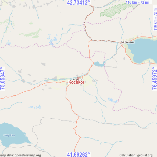
Kochkor GPS coordinates[2]
42° 12' 55.872" North, 75° 45' 23.724" East
| Map corner | latitude | longitude |
|---|---|---|
| Upper-left | 42.73412°, | 75.05347° |
| Center: | 42.21552°, | 75.75659° |
| Lower-right: | 41.69262°, | 76.45972° |
| Map W x H: | 115.8×115.8 km | = 72×72mi |
| max Lat: | 42.89106° ⇑28.6% North |
| Kochkor: | 42.21552° |
| min Lat: | ⇓71.4% South 39.55274° |
| min Long | Kochkor | max Long |
| 69.3716° | 75.75659° | 78.52702° |
| W 86.9%⇐ | ⇒13.1% E |
Elevation
Elevation of Kochkor is 1808 m = 5932 ft, and this is 606.6 m = 1990 ft above average elevation for this country.
| Max E: |
2638 m = 8655 ft | 10.7% |
| Kochkor | 1808 m 5932 ft | |
| Avg. | 1201.4 m = 3942 ft | |
Min E: |
504 m = 1654 ft | 89.3% |
See also: Kyrgyzstan elevation on elevation.city.
Geographical zone
Kochkor is located in North temperate zone (between Tropic of Cancer and the Arctic Circle). Distance of this Northern Tropic circle is 2088 km =1297.4 mi to South.| Distance of | km | miles | from Kochkor |
|---|---|---|---|
| North Pole | 5313.1 | 3301.4 | to North |
| Arctic Circle | 2707.2 | 1682.2 | to North |
| Tropic Cancer | 2088 | 1297.4 | to South |
| Equator | 4693.9 | 2916.7 | to South |


Nearby cities:
15 places around Kochkor: (largest is in red/bold)
• At-Bashi
116.4 km =72.3 mi,  178°
178°
• Baetovo
124.6 km =77.4 mi,  212°
212°
• Balykchy
44.6 km =27.7 mi,  52°
52°
• Bishkek
120.1 km =74.6 mi,  307°
307°
• Bokombayevskoye
102.5 km =63.7 mi,  96°
96°
• Chayek
107.2 km =66.6 mi,  252°
252°
• Cholpon-Ata
119 km =73.9 mi,  66°
66°
• Chuy
77.6 km =48.2 mi,  329°
329°
• Ivanovka
92.8 km =57.7 mi,  323°
323°
• Kadzhi-Say
117.5 km =73 mi,  94°
94°
• Kant
105.6 km =65.6 mi, 315°
• Kemin
63.7 km =39.6 mi,  355°
355°
• Lebedinovka
115.5 km =71.8 mi, 310°
• Naryn
89.6 km =55.7 mi,  167°
167°
• Tokmok
79 km =49.1 mi, 331°
Sources, notices
• [Note1] Compared only with cities in Kyrgyzstan existing in our database
• [Src1] Map data: © OpenStreetMap contributors (CC-BY-SA)
• [Src2] Other city data from geonames.org with taken over terms of usage.
• [Src3] Geographical zone / Annual Mean Temperature by Robert A. Rohde @ Wikipedia
