Lebedinovka geodata
Lebedinovka (Chüy) is a seat of a second-order administrative division; located in Kyrgyzstan in Asia/Bishkek (GMT+6) time zone. In our database, there are 37 cities with bigger population. Compared to other cities in Kyrgyzstan, 97.6% of cities are located further ↓South; 78.6% of cities are located further ←West and 90.5% of cities have higher elevation than Lebedinovka. Note1


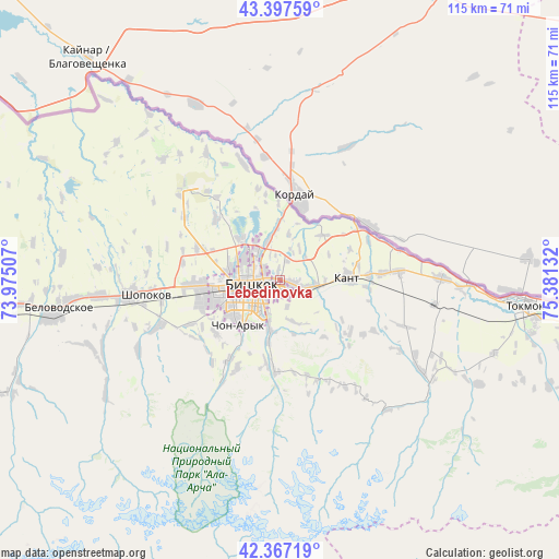
Lebedinovka GPS coordinates[2]
42° 53' 4.344" North, 74° 40' 41.484" East
| Map corner | latitude | longitude |
|---|---|---|
| Upper-left | 43.39759°, | 73.97507° |
| Center: | 42.88454°, | 74.67819° |
| Lower-right: | 42.36719°, | 75.38132° |
| Map W x H: | 114.6×114.6 km | = 71.2×71.2mi |
| max Lat: | 42.89106° ⇑2.4% North |
| Lebedinovka: | 42.88454° |
| min Lat: | ⇓97.6% South 39.55274° |
| min Long | Lebedinovka | max Long |
| 69.3716° | 74.67819° | 78.52702° |
| W 78.6%⇐ | ⇒21.4% E |
Elevation
Elevation of Lebedinovka is 732 m = 2402 ft, and this is 469.4 m = 1540 ft below average elevation for this country.
| Max E: |
2638 m = 8655 ft | 90.5% |
| Avg. | 1201.4 m = 3942 ft | |
| Lebedinovka | 732 m = 2402 ft | |
Min E: |
504 m = 1654 ft | 9.5% |
See also: Kyrgyzstan elevation on elevation.city.
Geographical zone
Lebedinovka is located in North temperate zone (between Tropic of Cancer and the Arctic Circle). Distance of this Northern Tropic circle is 2162.4 km =1343.7 mi to South.| Distance of | km | miles | from Lebedinovka |
|---|---|---|---|
| North Pole | 5238.7 | 3255.2 | to North |
| Arctic Circle | 2632.9 | 1636 | to North |
| Tropic Cancer | 2162.4 | 1343.7 | to South |
| Equator | 4768.3 | 2962.9 | to South |


Nearby cities:
15 places around Lebedinovka: (largest is in red/bold)
• Balykchy
132.1 km =82.1 mi,  110°
110°
• Belovodskoye
46.9 km =29.1 mi,  262°
262°
• Bishkek
7.4 km =4.6 mi, 257°
• Chayek
107.2 km =66.6 mi,  187°
187°
• Chuy
49.8 km =30.9 mi,  98°
98°
• Ivanovka
33.1 km =20.6 mi,  89°
89°
• Kaindy
82 km =51 mi,  265°
265°
• Kant
14.1 km =8.8 mi, 87°
• Kara-Balta
68.1 km =42.3 mi, 263°
• Kazarman
173.1 km =107.6 mi,  198°
198°
• Kemin
83.4 km =51.8 mi, 97°
• Kochkor
115.5 km =71.8 mi,  130°
130°
• Sokuluk
30.8 km =19.1 mi, 263°
• Sosnovka
69.5 km =43.2 mi,  246°
246°
• Tokmok
51 km =31.7 mi, 95°
Sources, notices
• [Note1] Compared only with cities in Kyrgyzstan existing in our database
• [Src1] Map data: © OpenStreetMap contributors (CC-BY-SA)
• [Src2] Other city data from geonames.org with taken over terms of usage.
• [Src3] Geographical zone / Annual Mean Temperature by Robert A. Rohde @ Wikipedia
