Ivanovka geodata
Ivanovka (Chüy) is a seat of a second-order administrative division; located in Kyrgyzstan in Asia/Bishkek (GMT+6) time zone. In our database, there are 37 cities with bigger population. Compared to other cities in Kyrgyzstan, 98.8% of cities are located further ↓South; 82.1% of cities are located further ←West and 83.3% of cities have higher elevation than Ivanovka. Note1


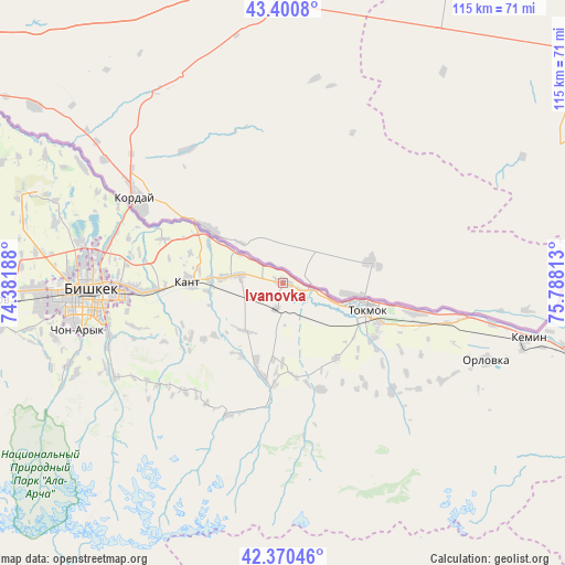
Ivanovka GPS coordinates[2]
42° 53' 16.008" North, 75° 5' 6" East
| Map corner | latitude | longitude |
|---|---|---|
| Upper-left | 43.4008°, | 74.38188° |
| Center: | 42.88778°, | 75.085° |
| Lower-right: | 42.37046°, | 75.78813° |
| Map W x H: | 114.6×114.6 km | = 71.2×71.2mi |
| max Lat: | 42.89106° ⇑1.2% North |
| Ivanovka: | 42.88778° |
| min Lat: | ⇓98.8% South 39.55274° |
| min Long | Ivanovka | max Long |
| 69.3716° | 75.085° | 78.52702° |
| W 82.1%⇐ | ⇒17.9% E |
Elevation
Elevation of Ivanovka is 745 m = 2444 ft, and this is 456.4 m = 1497 ft below average elevation for this country.
| Max E: |
2638 m = 8655 ft | 83.3% |
| Avg. | 1201.4 m = 3942 ft | |
| Ivanovka | 745 m = 2444 ft | |
Min E: |
504 m = 1654 ft | 16.7% |
See also: Kyrgyzstan elevation on elevation.city.
Geographical zone
Ivanovka is located in North temperate zone (between Tropic of Cancer and the Arctic Circle). Distance of this Northern Tropic circle is 2162.8 km =1343.9 mi to South.| Distance of | km | miles | from Ivanovka |
|---|---|---|---|
| North Pole | 5238.4 | 3255 | to North |
| Arctic Circle | 2632.5 | 1635.8 | to North |
| Tropic Cancer | 2162.8 | 1343.9 | to South |
| Equator | 4768.7 | 2963.1 | to South |


Nearby cities:
15 places around Ivanovka: (largest is in red/bold)
• Balykchy
101.9 km =63.3 mi,  117°
117°
• Belovodskoye
79.9 km =49.6 mi,  265°
265°
• Bishkek
40.4 km =25.1 mi, 267°
• Chayek
116.5 km =72.4 mi,  203°
203°
• Cholpon-Ata
165.2 km =102.7 mi,  99°
99°
• Chuy
17.8 km =11.1 mi, 115°
• Kaindy
115.1 km =71.5 mi, 266°
• Kant
19.1 km =11.9 mi, 271°
• Kara-Balta
101.2 km =62.9 mi, 265°
• Kemin
50.7 km =31.5 mi, 102°
• Kochkor
92.8 km =57.7 mi,  143°
143°
• Lebedinovka
33.1 km =20.6 mi, 269°
• Sokuluk
63.9 km =39.7 mi, 266°
• Sosnovka
101 km =62.8 mi,  253°
253°
• Tokmok
18.4 km =11.4 mi,  106°
106°
Sources, notices
• [Note1] Compared only with cities in Kyrgyzstan existing in our database
• [Src1] Map data: © OpenStreetMap contributors (CC-BY-SA)
• [Src2] Other city data from geonames.org with taken over terms of usage.
• [Src3] Geographical zone / Annual Mean Temperature by Robert A. Rohde @ Wikipedia
